North Adams night lights from space
Night Light of North Adams (Massachusetts) from space (United States) Src. Average luminocity for 10x10km area is 12.5167% and for 50x50km: 2.159%.
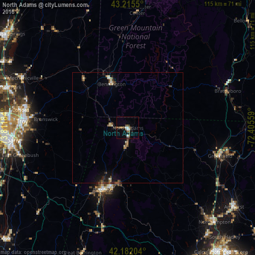
Analysis of North Adams night lights 2016
Square area 10x10 km:
 1.21%
1.21%90-99
1.82%80-89
0%70-79
1.21%60-69
2.58%50-59
2.27%40-49
2.88%30-39
1.97%20-29
1.21%10-19
3.03%0-9
81.82%Square area 50x50 km:
0.08%90-99
0.3%80-89
0.23%70-79
0.16%60-69
0.31%50-59
0.43%40-49
0.39%30-39
0.41%20-29
0.52%10-19
1.01%0-9
96.16%Clear (daylight) street map image can be seen on geolist.org.
Map coordinates:
43° 12' 55.8" North, 73° 48' 42.6" West
42° 42' 3.3" North, 73° 6' 31.4" West
42° 10' 55.3" North, 72° 24' 20.1" West
Some cities around North Adams sort by population:
• Troy
47.7 km =29.6 mi,  273°
273°
• Pittsfield
30.1 km =18.7 mi,  201°
201°
• Greenfield
43.5 km =27 mi,  106°
106°
• Watervliet
48.5 km =30.1 mi, 273°
• Bennington
21 km =13 mi,  339°
339°
• Brattleboro
48 km =29.8 mi,  69°
69°
• Dalton
25.7 km =16 mi,  190°
190°
• Adams
8.6 km =5.3 mi,  184°
184°
4945486 (p: 13,263)
Sources (retrieved 2019-11-25):
» Earth at Night: Flat Maps 2012, 2016