Dalton night lights from space
Night Light of Dalton (Massachusetts) from space (United States) Src. Average luminocity for 10x10km area is 22.1079% and for 50x50km: 3.4083%.
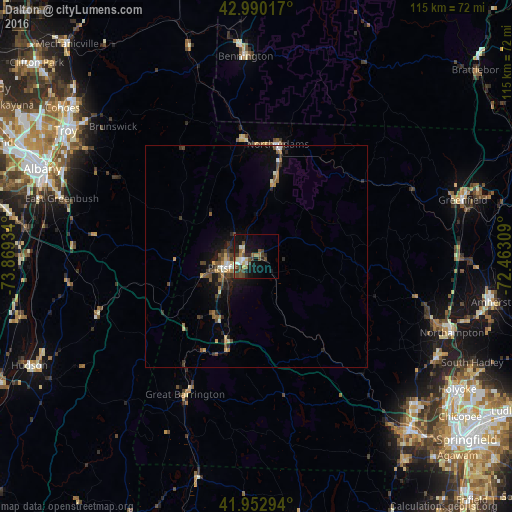
Analysis of Dalton night lights 2016
Square area 10x10 km:
 2.38%
2.38%90-99
1.9%80-89
3.81%70-79
1.59%60-69
2.06%50-59
4.29%40-49
7.46%30-39
3.97%20-29
4.92%10-19
19.05%0-9
48.57%Square area 50x50 km:
0.18%90-99
0.35%80-89
0.39%70-79
0.35%60-69
0.45%50-59
0.63%40-49
0.86%30-39
0.63%20-29
0.89%10-19
2.37%0-9
92.89%Clear (daylight) street map image can be seen on geolist.org.
Map coordinates:
42° 59' 24.6" North, 73° 52' 9.6" West
42° 28' 25.3" North, 73° 9' 58.4" West
41° 57' 10.6" North, 72° 27' 47.1" West
Some cities around Dalton sort by population:
• Pittsfield
7 km =4.3 mi,  247°
247°
• Northampton
46.2 km =28.7 mi,  110°
110°
• Greenfield
48.1 km =29.9 mi,  74°
74°
• Easthampton
46.9 km =29.1 mi,  119°
119°
• North Adams
25.7 km =16 mi,  10°
10°
• Bennington
45 km =28 mi,  356°
356°
• Adams
17.2 km =10.7 mi, 13°
• Southampton
45 km =28 mi,  127°
127°
4934429 (p: 7,012)
Sources (retrieved 2019-11-25):
» Earth at Night: Flat Maps 2012, 2016