Pineville night lights from space
Night Light of Pineville (Louisiana) from space (United States) Src. Average luminocity for 10x10km area is 70.4301% and for 50x50km: 10.0897%.
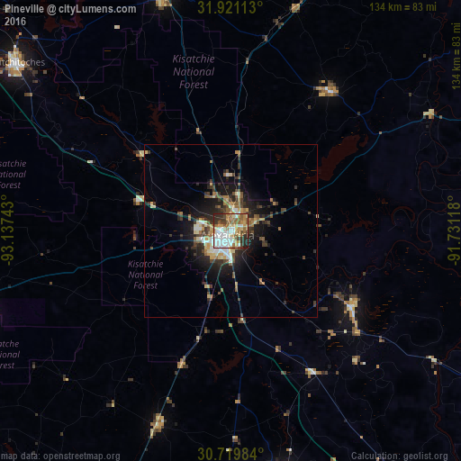
Analysis of Pineville night lights 2016
Square area 10x10 km:
 18.36%
90-99
15.73%80-89
10.31%70-79
9.62%60-69
10.49%50-59
12.24%40-49
3.67%30-39
9.44%20-29
9.09%10-19
1.05%0-9
0%Square area 50x50 km:
1.23%90-99
1.29%80-89
1.48%70-79
1.16%60-69
1.3%50-59
1.78%40-49
1.36%30-39
2.43%20-29
2.73%10-19
6.19%0-9
79.06%Clear (daylight) street map image can be seen on geolist.org.
Map coordinates:
31° 55' 16.1" North, 93° 8' 14.7" West
31° 19' 20.6" North, 92° 26' 3.5" West
30° 43' 11.4" North, 91° 43' 52.2" West
Some cities around Pineville sort by population:
• Alexandria
1.6 km =1 mi,  219°
219°
• Natchitoches
78.7 km =48.9 mi,  308°
308°
• Eunice
92.1 km =57.2 mi,  179°
179°
• Fort Polk South
80.2 km =49.8 mi,  247°
247°
• Oakdale
60.3 km =37.5 mi,  200°
200°
• Ville Platte
72.2 km =44.9 mi,  167°
167°
• Leesville
81.1 km =50.4 mi,  255°
255°
• Marksville
41.1 km =25.5 mi,  121°
121°
4337291 (p: 14,403)
Sources (retrieved 2019-11-25):
» Earth at Night: Flat Maps 2012, 2016