Marksville night lights from space
Night Light of Marksville (Louisiana) from space (United States) Src. Average luminocity for 10x10km area is 24.4634% and for 50x50km: 2.8413%.
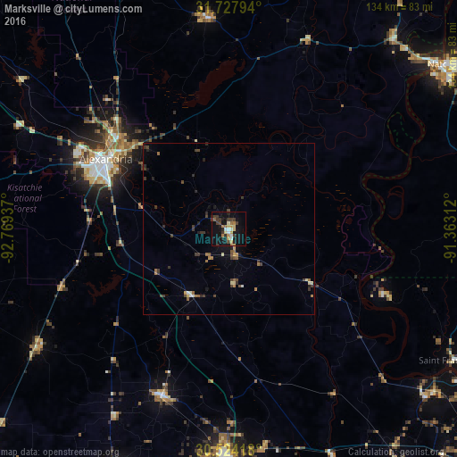
Analysis of Marksville night lights 2016
Square area 10x10 km:
 1.47%
1.47%90-99
3.48%80-89
3.3%70-79
4.95%60-69
2.75%50-59
0.92%40-49
2.93%30-39
7.88%20-29
4.21%10-19
27.47%0-9
40.66%Square area 50x50 km:
0.1%90-99
0.25%80-89
0.35%70-79
0.39%60-69
0.44%50-59
0.3%40-49
0.5%30-39
1.06%20-29
0.54%10-19
1.52%0-9
94.56%Clear (daylight) street map image can be seen on geolist.org.
Map coordinates:
31° 43' 40.6" North, 92° 46' 9.7" West
31° 7' 40.7" North, 92° 3' 58.5" West
30° 31' 27" North, 91° 21' 47.2" West
Some cities around Marksville sort by population:
• Alexandria
41.4 km =25.7 mi,  299°
299°
• Opelousas
66.1 km =41.1 mi,  181°
181°
• Natchez
79.2 km =49.2 mi,  52°
52°
• Pineville
41.1 km =25.5 mi, 301°
• Eunice
78 km =48.5 mi,  205°
205°
• Carencro
90.2 km =56 mi, 178°
• Oakdale
66.4 km =41.3 mi,  238°
238°
• Ville Platte
52.7 km =32.7 mi,  201°
201°
4332604 (p: 5,533)
Sources (retrieved 2019-11-25):
» Earth at Night: Flat Maps 2012, 2016