Fort Polk South night lights from space
Night Light of Fort Polk South (Louisiana) from space (United States) Src. Average luminocity for 10x10km area is 33.4908% and for 50x50km: 5.5177%.
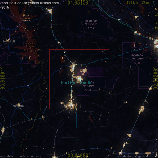
Analysis of Fort Polk South night lights 2016
Square area 10x10 km:
 2.75%
2.75%90-99
3.85%80-89
5.49%70-79
2.01%60-69
7.33%50-59
8.97%40-49
2.93%30-39
4.21%20-29
7.88%10-19
39.01%0-9
15.57%Square area 50x50 km:
0.27%90-99
0.48%80-89
0.89%70-79
0.6%60-69
0.81%50-59
1.22%40-49
0.82%30-39
0.95%20-29
1.13%10-19
5.67%0-9
87.15%Clear (daylight) street map image can be seen on geolist.org.
Map coordinates:
31° 39' 5.6" North, 93° 55' 8.1" West
31° 3' 4" North, 93° 12' 56.8" West
30° 26' 48.6" North, 92° 30' 45.6" West
Some cities around Fort Polk South sort by population:
• Alexandria
78.8 km =49 mi,  68°
68°
• Natchitoches
79.9 km =49.6 mi,  8°
8°
• Pineville
80.2 km =49.8 mi, 67°
• Moss Bluff
83.2 km =51.7 mi,  178°
178°
• DeRidder
23.8 km =14.8 mi,  197°
197°
• Oakdale
59.1 km =36.7 mi,  116°
116°
• Jasper
75.8 km =47.1 mi,  258°
258°
• Leesville
11.1 km =6.9 mi,  337°
337°
7259776 (p: 9,038)
Sources (retrieved 2019-11-25):
» Earth at Night: Flat Maps 2012, 2016