Oakdale night lights from space
Night Light of Oakdale (Louisiana) from space (United States) Src. Average luminocity for 10x10km area is 15.0577% and for 50x50km: 1.8641%.
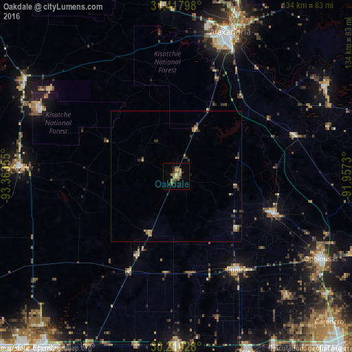
Analysis of Oakdale night lights 2016
Square area 10x10 km:
 0.35%
0.35%90-99
0.87%80-89
2.97%70-79
2.97%60-69
1.57%50-59
5.42%40-49
1.57%30-39
2.45%20-29
1.22%10-19
1.92%0-9
78.67%Square area 50x50 km:
0.05%90-99
0.08%80-89
0.31%70-79
0.43%60-69
0.28%50-59
0.36%40-49
0.27%30-39
0.62%20-29
0.21%10-19
0.23%0-9
97.16%Clear (daylight) street map image can be seen on geolist.org.
Map coordinates:
31° 25' 4.7" North, 93° 21' 48.8" West
30° 48' 57.7" North, 92° 39' 37.5" West
30° 12' 37" North, 91° 57' 26.3" West
Some cities around Oakdale sort by population:
• Alexandria
58.8 km =36.5 mi,  20°
20°
• Opelousas
63.7 km =39.6 mi,  119°
119°
• Pineville
60.3 km =37.5 mi, 20°
• DeRidder
60.1 km =37.3 mi,  273°
273°
• Eunice
42.6 km =26.5 mi,  147°
147°
• Jennings
66 km =41 mi,  179°
179°
• Fort Polk South
59.1 km =36.7 mi,  296°
296°
• Ville Platte
39.8 km =24.7 mi,  110°
110°
4335796 (p: 7,710)
Sources (retrieved 2019-11-25):
» Earth at Night: Flat Maps 2012, 2016