Peoria night lights from space
Night Light of Peoria (Illinois) from space (United States) Src. Average luminocity for 10x10km area is 83.8571% and for 50x50km: 18.8642%.
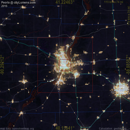
Analysis of Peoria night lights 2016
Square area 10x10 km:
 27.27%
90-99
27.92%80-89
8.12%70-79
8.93%60-69
12.34%50-59
12.82%40-49
1.3%30-39
1.3%20-29
0%10-19
0%0-9
0%Square area 50x50 km:
2.25%90-99
2.93%80-89
2.73%70-79
2.37%60-69
3.02%50-59
3.33%40-49
2.9%30-39
3.21%20-29
5.39%10-19
9.09%0-9
62.79%Clear (daylight) street map image can be seen on geolist.org.
Map coordinates:
41° 13' 28.7" North, 90° 17' 31.6" West
40° 41' 37.1" North, 89° 35' 20.4" West
40° 9' 30.3" North, 88° 53' 9.1" West
Some cities around Peoria sort by population:
• North Peoria
2.7 km =1.7 mi,  8°
8°
• Pekin
14.7 km =9.1 mi,  197°
197°
• East Peoria
3.1 km =1.9 mi,  166°
166°
• Washington
15.4 km =9.6 mi,  85°
85°
• Morton
14.2 km =8.8 mi,  129°
129°
• Bartonville
7.2 km =4.5 mi,  227°
227°
• Eureka
26.8 km =16.7 mi,  83°
83°
• Creve Coeur
5.2 km =3.2 mi,  182°
182°
4905687 (p: 115,070)
Sources (retrieved 2019-11-25):
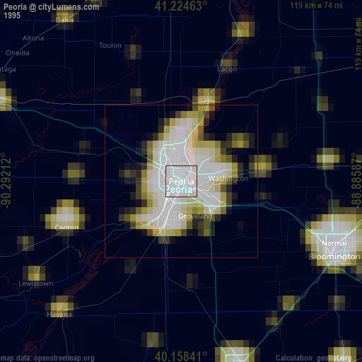
» NASA, Earths city lights 1995
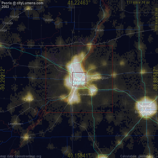
» NASA city lights 2003
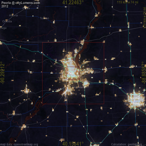
» Earth at Night: Flat Maps 2012, 2016