North Peoria night lights from space
Night Light of North Peoria (Illinois) from space (United States) Src. Average luminocity for 10x10km area is 82.3571% and for 50x50km: 19.0796%.
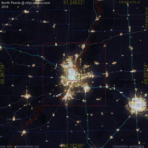
Analysis of North Peoria night lights 2016
Square area 10x10 km:
 27.6%
27.6%90-99
30.84%80-89
7.31%70-79
5.84%60-69
8.6%50-59
8.93%40-49
3.41%30-39
3.73%20-29
3.73%10-19
0%0-9
0%Square area 50x50 km:
2.26%90-99
2.95%80-89
2.84%70-79
2.39%60-69
3.06%50-59
3.35%40-49
2.94%30-39
3.23%20-29
5.39%10-19
9.12%0-9
62.48%Clear (daylight) street map image can be seen on geolist.org.
Map coordinates:
41° 14' 54" North, 90° 17' 14.6" West
40° 43' 3.1" North, 89° 35' 3.3" West
40° 10' 57" North, 88° 52' 52.1" West
Some cities around North Peoria sort by population:
• Peoria
2.7 km =1.7 mi,  188°
188°
• Pekin
17.3 km =10.7 mi,  195°
195°
• East Peoria
5.7 km =3.5 mi,  176°
176°
• Washington
15 km =9.3 mi,  95°
95°
• Morton
15.7 km =9.8 mi,  137°
137°
• Bartonville
9.4 km =5.8 mi,  217°
217°
• Peoria Heights
3.4 km =2.1 mi,  14°
14°
• Creve Coeur
7.8 km =4.8 mi, 184°
4903976 (p: 113,004)
Sources (retrieved 2019-11-25):
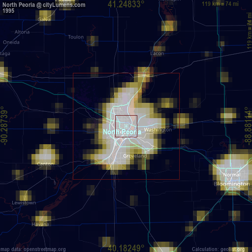
» NASA, Earths city lights 1995
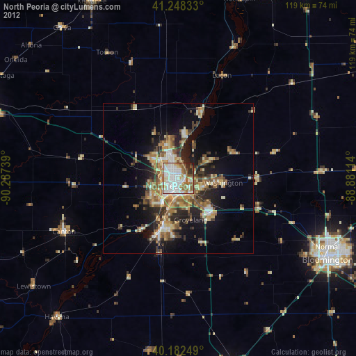
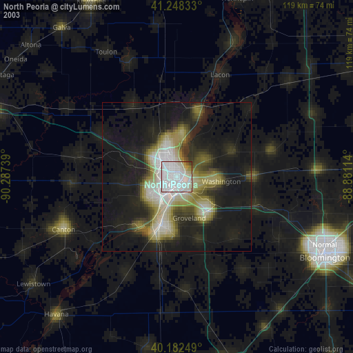
» NASA city lights 2003
» Earth at Night: Flat Maps 2012, 2016