East Peoria night lights from space
Night Light of East Peoria (Illinois) from space (United States) Src. Average luminocity for 10x10km area is 72.901% and for 50x50km: 18.7032%.
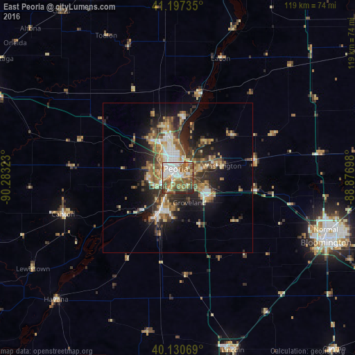
Analysis of East Peoria night lights 2016
Square area 10x10 km:
 17.05%
90-99
16.56%80-89
8.28%70-79
10.06%60-69
14.77%50-59
21.1%40-49
5.19%30-39
3.73%20-29
3.25%10-19
0%0-9
0%Square area 50x50 km:
2.24%90-99
2.91%80-89
2.69%70-79
2.35%60-69
2.99%50-59
3.31%40-49
2.9%30-39
3.17%20-29
5.37%10-19
9.06%0-9
63.02%Clear (daylight) street map image can be seen on geolist.org.
Map coordinates:
41° 11' 50.5" North, 90° 16' 59.6" West
40° 39' 58.1" North, 89° 34' 48.4" West
40° 7' 50.5" North, 88° 52' 37.1" West
Some cities around East Peoria sort by population:
• Peoria
3.1 km =1.9 mi,  346°
346°
• North Peoria
5.7 km =3.5 mi,  356°
356°
• Pekin
12.1 km =7.5 mi,  204°
204°
• Washington
15.2 km =9.4 mi,  74°
74°
• Morton
11.8 km =7.3 mi,  120°
120°
• Bartonville
6.3 km =3.9 mi,  253°
253°
• Peoria Heights
9 km =5.6 mi,  3°
3°
• Creve Coeur
2.3 km =1.4 mi, 204°
4890549 (p: 23,080)
Sources (retrieved 2019-11-25):
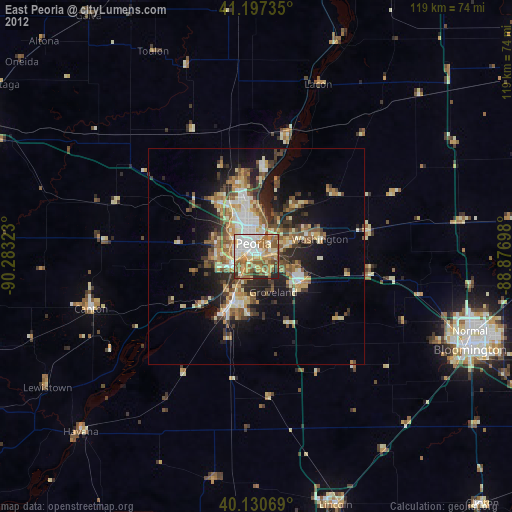
» Earth at Night: Flat Maps 2012, 2016