Peekskill night lights from space
Night Light of Peekskill (New York) from space (United States) Src. Average luminocity for 10x10km area is 38.7532% and for 50x50km: 29.7155%.
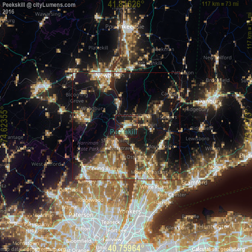
Analysis of Peekskill night lights 2016
Square area 10x10 km:
 2.27%
2.27%90-99
5.19%80-89
6.98%70-79
6.66%60-69
6.49%50-59
2.92%40-49
3.08%30-39
11.04%20-29
21.27%10-19
30.36%0-9
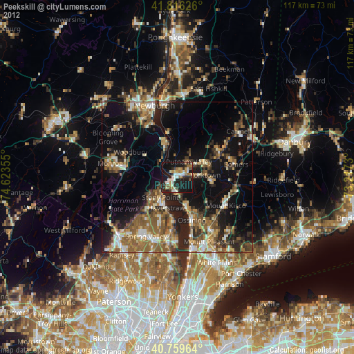
3.73%Square area 50x50 km:
2.57%90-99
3.36%80-89
4.03%70-79
4.35%60-69
6.02%50-59
5.08%40-49
5.05%30-39
5.58%20-29
9.63%10-19
21.08%0-9
33.24%Clear (daylight) street map image can be seen on geolist.org.
Map coordinates:
41° 48' 58.5" North, 74° 37' 24.8" West
41° 17' 24.3" North, 73° 55' 13.5" West
40° 45' 34.7" North, 73° 13' 2.3" West
Some cities around Peekskill sort by population:
• Jefferson Valley-Yorktown
10.5 km =6.5 mi,  72°
72°
• Haverstraw
10.9 km =6.8 mi,  199°
199°
• Stony Point
8.7 km =5.4 mi,  219°
219°
• West Haverstraw
10.5 km =6.5 mi,  211°
211°
• Croton-on-Hudson
9.4 km =5.8 mi,  164°
164°
• West Point
11.7 km =7.3 mi,  345°
345°
• Lake Mohegan
6.9 km =4.3 mi,  63°
63°
• Thiells
12 km =7.5 mi, 222°
5130831 (p: 24,043)
Sources (retrieved 2019-11-25):
» Earth at Night: Flat Maps 2012, 2016