Pecos night lights from space
Night Light of Pecos (Texas) from space (United States) Src. Average luminocity for 10x10km area is 37.7238% and for 50x50km: 3.8399%.
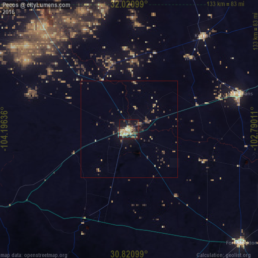
Analysis of Pecos night lights 2016
Square area 10x10 km:
 2.62%
2.62%90-99
3.85%80-89
6.64%70-79
10.49%60-69
4.37%50-59
3.67%40-49
6.47%30-39
6.64%20-29
6.47%10-19
38.81%0-9
9.97%Square area 50x50 km:
0.11%90-99
0.17%80-89
0.63%70-79
0.68%60-69
0.37%50-59
0.51%40-49
0.97%30-39
1.09%20-29
0.84%10-19
2.65%0-9
91.96%Clear (daylight) street map image can be seen on geolist.org.
Map coordinates:
32° 1' 15.6" North, 104° 11' 46.9" West
31° 25' 22.5" North, 103° 29' 35.6" West
30° 49' 15.6" North, 102° 47' 24.4" West
Some cities around Pecos sort by population:
• Odessa
116.5 km =72.4 mi,  66°
66°
• Carlsbad
130.9 km =81.3 mi,  327°
327°
• West Odessa
105.1 km =65.3 mi,  63°
63°
• Andrews
133.9 km =83.2 mi,  41°
41°
• Fort Stockton
82.9 km =51.5 mi,  135°
135°
• Monahans
60 km =37.3 mi, 71°
• Kermit
61.4 km =38.2 mi, 38°
• Alpine
119.4 km =74.2 mi,  187°
187°
5528182 (p: 9,517)
Sources (retrieved 2019-11-25):
» Earth at Night: Flat Maps 2012, 2016