Carlsbad night lights from space
Night Light of Carlsbad (New Mexico) from space (United States) Src. Average luminocity for 10x10km area is 54.6832% and for 50x50km: 4.8075%.
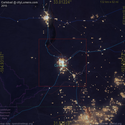
Analysis of Carlsbad night lights 2016
Square area 10x10 km:
 8.97%
8.97%90-99
10.44%80-89
9.34%70-79
12.82%60-69
8.06%50-59
4.95%40-49
2.93%30-39
4.4%20-29
20.7%10-19
16.85%0-9
0.55%Square area 50x50 km:
0.44%90-99
0.5%80-89
0.67%70-79
0.88%60-69
0.61%50-59
0.72%40-49
0.61%30-39
0.69%20-29
1.42%10-19
3.37%0-9
90.08%Clear (daylight) street map image can be seen on geolist.org.
Map coordinates:
33° 0' 44.1" North, 104° 55' 55.1" West
32° 25' 14.4" North, 104° 13' 43.8" West
31° 49' 30.7" North, 103° 31' 32.6" West
Some cities around Carlsbad sort by population:
• Roswell
111.7 km =69.4 mi,  345°
345°
• Hobbs
107.1 km =66.5 mi,  72°
72°
• Artesia
49.6 km =30.8 mi,  340°
340°
• Lovington
100.9 km =62.7 mi,  54°
54°
• Pecos
130.9 km =81.3 mi,  147°
147°
• Monahans
155.9 km =96.9 mi,  126°
126°
• Seminole
152.1 km =94.5 mi,  77°
77°
• Kermit
123.9 km =77 mi,  120°
120°
5460459 (p: 28,957)
Sources (retrieved 2019-11-25):
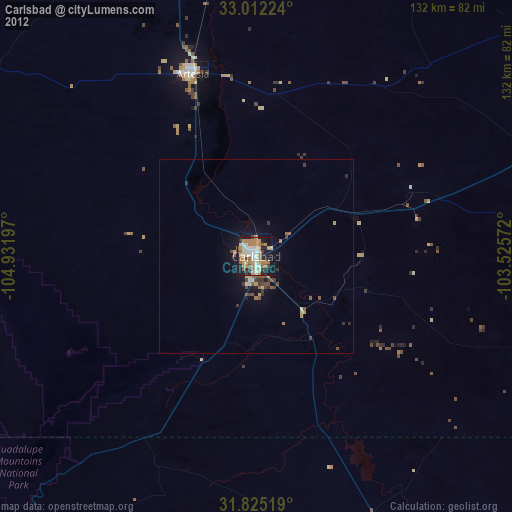
» Earth at Night: Flat Maps 2012, 2016