Shawnee night lights from space
Night Light of Shawnee (Kansas) from space (United States) Src. Average luminocity for 10x10km area is 84.7532% and for 50x50km: 63.6525%.
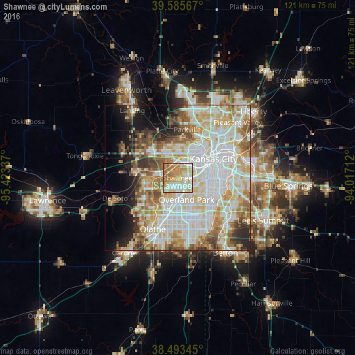
Analysis of Shawnee night lights 2016
Square area 10x10 km:
 19.81%
90-99
26.14%80-89
17.53%70-79
17.86%60-69
13.96%50-59
4.71%40-49
0%30-39
0%20-29
0%10-19
0%0-9
0%Square area 50x50 km:
18.82%90-99
17.79%80-89
9.83%70-79
7.35%60-69
7.37%50-59
5.95%40-49
4.37%30-39
4.21%20-29
4.64%10-19
6.26%0-9
13.41%Clear (daylight) street map image can be seen on geolist.org.
Map coordinates:
39° 35' 8.4" North, 95° 25' 24.1" West
39° 2' 30" North, 94° 43' 12.9" West
38° 29' 36.4" North, 94° 1' 1.6" West
Some cities around Shawnee sort by population:
• Overland Park
7.9 km =4.9 mi,  147°
147°
• Kansas City
11.4 km =7.1 mi,  44°
44°
• Lenexa
9.9 km =6.2 mi,  186°
186°
• Leawood
12.2 km =7.6 mi,  133°
133°
• Prairie Village
9.3 km =5.8 mi, 126°
• Merriam
3.1 km =1.9 mi, 131°
• Mission
5.8 km =3.6 mi,  105°
105°
• Roeland Park
7.6 km =4.7 mi,  93°
93°
4279247 (p: 65,046)
Sources (retrieved 2019-11-25):
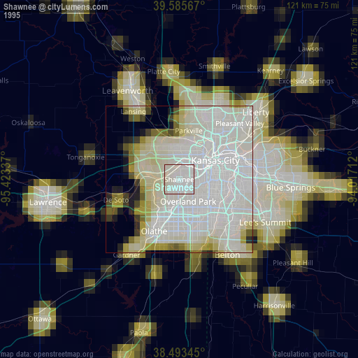
» NASA, Earths city lights 1995
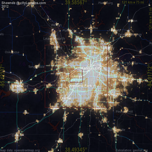
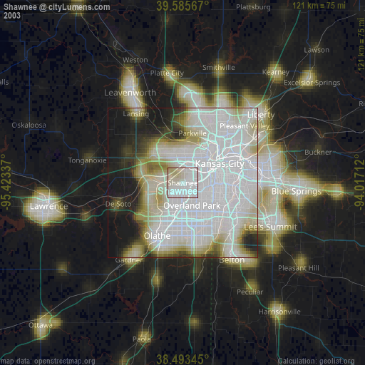
» NASA city lights 2003
» Earth at Night: Flat Maps 2012, 2016