Mission night lights from space
Night Light of Mission (Kansas) from space (United States) Src. Average luminocity for 10x10km area is 94.0373% and for 50x50km: 69.3827%.
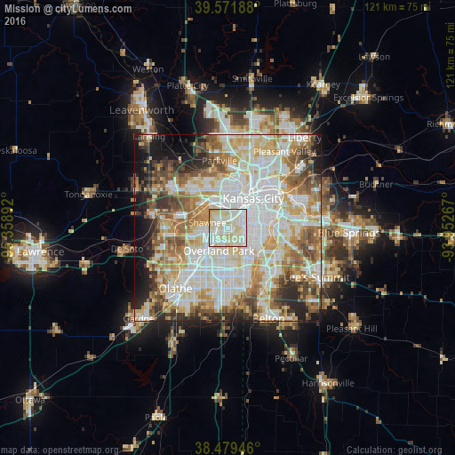
Analysis of Mission night lights 2016
Square area 10x10 km:
 32.63%
90-99
39.61%80-89
24.19%70-79
3.57%60-69
0%50-59
0%40-49
0%30-39
0%20-29
0%10-19
0%0-9
0%Square area 50x50 km:
19.62%90-99
18.68%80-89
10.48%70-79
8.16%60-69
8.88%50-59
7.39%40-49
5.87%30-39
5.3%20-29
6.01%10-19
6.44%0-9
3.18%Clear (daylight) street map image can be seen on geolist.org.
Map coordinates:
39° 34' 18.8" North, 95° 21' 32.1" West
39° 1' 40" North, 94° 39' 20.8" West
38° 28' 46.1" North, 93° 57' 9.6" West
Some cities around Mission sort by population:
• Kansas City
10.4 km =6.5 mi,  39°
39°
• Overland Park
5.2 km =3.2 mi,  194°
194°
• Kansas City
9.9 km =6.2 mi,  14°
14°
• Shawnee
5.8 km =3.6 mi,  285°
285°
• Leawood
7.6 km =4.7 mi,  153°
153°
• Prairie Village
4.5 km =2.8 mi, 154°
• Merriam
3.3 km =2.1 mi,  261°
261°
• Roeland Park
2.3 km =1.4 mi,  62°
62°
4275600 (p: 9,491)
Sources (retrieved 2019-11-25):
» Earth at Night: Flat Maps 2012, 2016