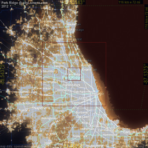
Park Ridge night lights from space
Night Light of Park Ridge (Illinois) from space (United States) Src. Average luminocity for 10x10km area is 97.7254% and for 50x50km: 72.3893%.
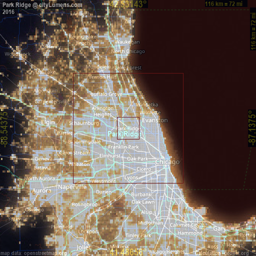
Analysis of Park Ridge night lights 2016
Square area 10x10 km:
 53.97%
90-99
38.57%80-89
6.98%70-79
0.48%60-69
0%50-59
0%40-49
0%30-39
0%20-29
0%10-19
0%0-9
0%Square area 50x50 km:
34.14%90-99
18.63%80-89
8.98%70-79
6.01%60-69
4.89%50-59
4.64%40-49
2.06%30-39
1.26%20-29
1.96%10-19
2.78%0-9
14.66%Clear (daylight) street map image can be seen on geolist.org.
Map coordinates:
42° 31' 53.1" North, 88° 32' 37.5" West
42° 0' 40.1" North, 87° 50' 26.2" West
41° 29' 11.6" North, 87° 8' 15" West
Some cities around Park Ridge sort by population:
• Portage Park
8.6 km =5.3 mi,  133°
133°
• Des Plaines
4.3 km =2.7 mi,  304°
304°
• Glenview
7.8 km =4.8 mi,  33°
33°
• Niles
3.2 km =2 mi,  74°
74°
• Morton Grove
5.8 km =3.6 mi,  55°
55°
• Norridge
5.4 km =3.4 mi,  168°
168°
• Schiller Park
6.6 km =4.1 mi,  202°
202°
• Harwood Heights
5.6 km =3.5 mi,  150°
150°
4905367 (p: 37,757)
Sources (retrieved 2019-11-25):
» Earth at Night: Flat Maps 2012, 2016