Des Plaines night lights from space
Night Light of Des Plaines (Illinois) from space (United States) Src. Average luminocity for 10x10km area is 95.2921% and for 50x50km: 74.4008%.

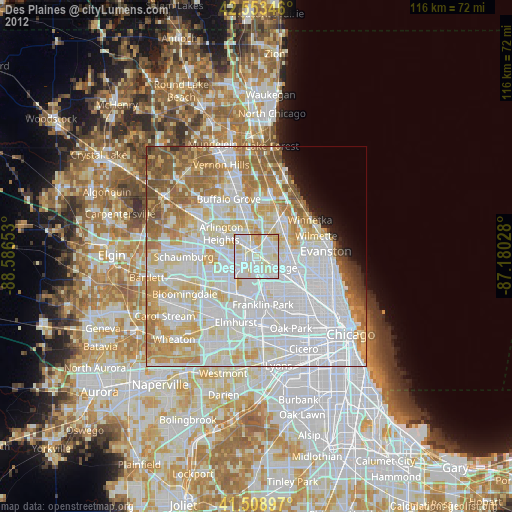
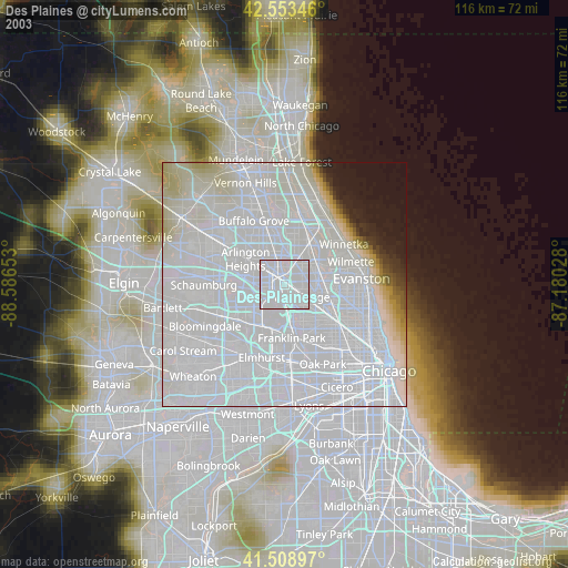
Analysis of Des Plaines night lights 2016
Square area 10x10 km:
 39.68%
90-99
41.27%80-89
14.92%70-79
3.81%60-69
0.32%50-59
0%40-49
0%30-39
0%20-29
0%10-19
0%0-9
0%Square area 50x50 km:
32.34%90-99
18.7%80-89
9.3%70-79
7.35%60-69
7.03%50-59
6.01%40-49
3.27%30-39
1.27%20-29
1.63%10-19
2.34%0-9
10.77%Clear (daylight) street map image can be seen on geolist.org.
Map coordinates:
42° 33' 12.5" North, 88° 35' 11.5" West
42° 2' 0.1" North, 87° 53' 0.2" West
41° 30' 32.3" North, 87° 10' 49" West
Some cities around Des Plaines sort by population:
• Mount Prospect
5.8 km =3.6 mi,  309°
309°
• Glenview
8.9 km =5.5 mi,  62°
62°
• Park Ridge
4.3 km =2.7 mi,  124°
124°
• Elk Grove Village
7.9 km =4.9 mi,  245°
245°
• Niles
6.8 km =4.2 mi,  103°
103°
• Morton Grove
8.4 km =5.2 mi,  84°
84°
• Prospect Heights
8.2 km =5.1 mi,  327°
327°
• Schiller Park
8.7 km =5.4 mi,  173°
173°
4889772 (p: 58,677)
Sources (retrieved 2019-11-25):
» NASA, Earths city lights 1995
» NASA city lights 2003
» Earth at Night: Flat Maps 2012, 2016