Schiller Park night lights from space
Night Light of Schiller Park (Illinois) from space (United States) Src. Average luminocity for 10x10km area is 98.6238% and for 50x50km: 82.6938%.
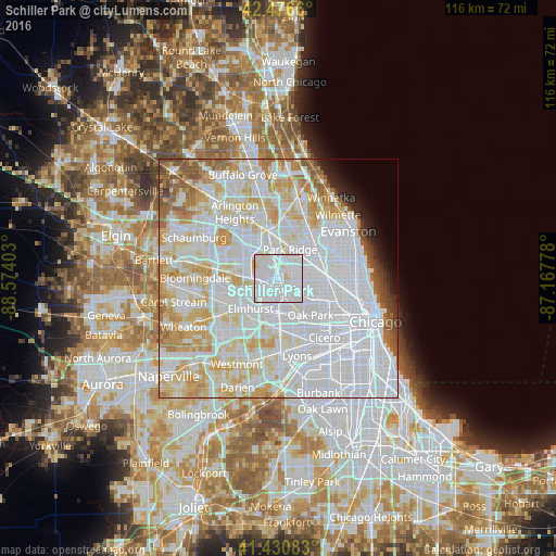
Analysis of Schiller Park night lights 2016
Square area 10x10 km:
 66.83%
90-99
27.62%80-89
5.24%70-79
0.32%60-69
0%50-59
0%40-49
0%30-39
0%20-29
0%10-19
0%0-9
0%Square area 50x50 km:
41.2%90-99
21.1%80-89
11.12%70-79
7.45%60-69
4.16%50-59
2.96%40-49
1.56%30-39
0.98%20-29
1.4%10-19
1.84%0-9
6.23%Clear (daylight) street map image can be seen on geolist.org.
Map coordinates:
42° 28' 35.8" North, 88° 34' 26.5" West
41° 57' 21.1" North, 87° 52' 15.2" West
41° 25' 51" North, 87° 10' 4" West
Some cities around Schiller Park sort by population:
• Melrose Park
6.3 km =3.9 mi,  169°
169°
• Elmwood Park
6.4 km =4 mi,  127°
127°
• Bensenville
5.7 km =3.5 mi,  269°
269°
• Franklin Park
2.3 km =1.4 mi, 169°
• Norridge
3.7 km =2.3 mi,  76°
76°
• Northlake
4.8 km =3 mi,  205°
205°
• River Grove
4.4 km =2.7 mi,  139°
139°
• Harwood Heights
5.4 km =3.4 mi, 76°
4910743 (p: 11,806)
Sources (retrieved 2019-11-25):
» Earth at Night: Flat Maps 2012, 2016