Broomall night lights from space
Night Light of Broomall (Pennsylvania) from space (United States) Src. Average luminocity for 10x10km area is 80.4439% and for 50x50km: 73.3606%.
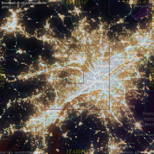
Analysis of Broomall night lights 2016
Square area 10x10 km:
 17.35%
90-99
17.86%80-89
15.65%70-79
17.18%60-69
24.83%50-59
6.46%40-49
0.68%30-39
0%20-29
0%10-19
0%0-9
0%Square area 50x50 km:
21.22%90-99
14.16%80-89
9.64%70-79
12.59%60-69
14.61%50-59
10.67%40-49
6.42%30-39
5.1%20-29
2.97%10-19
1.73%0-9
0.89%Clear (daylight) street map image can be seen on geolist.org.
Map coordinates:
40° 31' 5.3" North, 76° 3' 35" West
39° 58' 53.4" North, 75° 21' 23.7" West
39° 26' 26.2" North, 74° 39' 12.5" West
Some cities around Broomall sort by population:
• Wayne
7.4 km =4.6 mi,  339°
339°
• Radnor
7.2 km =4.5 mi,  357°
357°
• Drexel Hill
6.7 km =4.2 mi,  124°
124°
• Springfield
6.4 km =4 mi,  151°
151°
• Ardmore
6.7 km =4.2 mi,  65°
65°
• Clifton Heights
7.8 km =4.8 mi,  138°
138°
• Penn Wynne
6.9 km =4.3 mi,  85°
85°
• Media
7.7 km =4.8 mi,  200°
200°
4556802 (p: 10,789)
Sources (retrieved 2019-11-25):
» Earth at Night: Flat Maps 2012, 2016