Ocean Pines night lights from space
Night Light of Ocean Pines (Maryland) from space (United States) Src. Average luminocity for 10x10km area is 25.7143% and for 50x50km: 9.2185%.
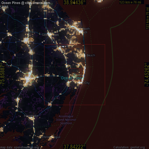
Analysis of Ocean Pines night lights 2016
Square area 10x10 km:
 0.34%
0.34%90-99
0.68%80-89
1.53%70-79
3.23%60-69
3.06%50-59
4.25%40-49
5.27%30-39
12.41%20-29
15.14%10-19
42.35%0-9
11.73%Square area 50x50 km:
0.51%90-99
0.58%80-89
1.26%70-79
1.38%60-69
1.23%50-59
1.34%40-49
1.58%30-39
2.39%20-29
2.61%10-19
11.37%0-9
75.76%Clear (daylight) street map image can be seen on geolist.org.
Map coordinates:
38° 56' 39.7" North, 75° 51' 31.9" West
38° 23' 43.4" North, 75° 9' 20.7" West
37° 50' 32" North, 74° 27' 9.4" West
Some cities around Ocean Pines sort by population:
• Salisbury
38.9 km =24.2 mi,  264°
264°
• Milford
62.2 km =38.6 mi,  337°
337°
• Villas
72.9 km =45.3 mi,  14°
14°
• Seaford
48.1 km =29.9 mi,  304°
304°
• Georgetown
38.4 km =23.9 mi,  328°
328°
• Cape May Court House
81.7 km =50.8 mi,  20°
20°
• Fruitland
41.3 km =25.7 mi, 258°
• Wildwood
72.6 km =45.1 mi, 24°
4364326 (p: 11,710)
Sources (retrieved 2019-11-25):
» Earth at Night: Flat Maps 2012, 2016