Fruitland night lights from space
Night Light of Fruitland (Maryland) from space (United States) Src. Average luminocity for 10x10km area is 39.1514% and for 50x50km: 6.9649%.
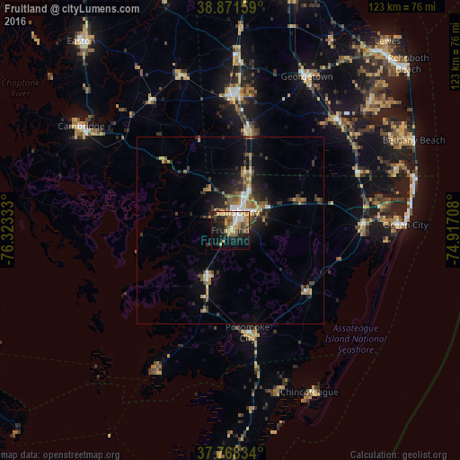
Analysis of Fruitland night lights 2016
Square area 10x10 km:
 3.91%
3.91%90-99
5.78%80-89
9.69%70-79
5.95%60-69
5.95%50-59
4.08%40-49
6.8%30-39
3.57%20-29
10.03%10-19
25%0-9
19.22%Square area 50x50 km:
0.71%90-99
0.7%80-89
0.76%70-79
0.88%60-69
1.15%50-59
1.11%40-49
1.2%30-39
1.45%20-29
2.15%10-19
4.01%0-9
85.87%Clear (daylight) street map image can be seen on geolist.org.
Map coordinates:
38° 52' 17.7" North, 76° 19' 24" West
38° 19' 19.4" North, 75° 37' 12.7" West
37° 46' 6" North, 74° 55' 1.5" West
Some cities around Fruitland sort by population:
• Salisbury
4.7 km =2.9 mi,  22°
22°
• Easton
64 km =39.8 mi,  321°
321°
• Cambridge
48.1 km =29.9 mi,  303°
303°
• Ocean Pines
41.3 km =25.7 mi,  78°
78°
• Milford
67.8 km =42.1 mi,  14°
14°
• Seaford
35.5 km =22.1 mi,  1°
1°
• Ocean City
46.7 km =29 mi,  88°
88°
• Georgetown
45.7 km =28.4 mi,  26°
26°
4355780 (p: 5,215)
Sources (retrieved 2019-11-25):
» Earth at Night: Flat Maps 2012, 2016