Georgetown night lights from space
Night Light of Georgetown (Delaware) from space (United States) Src. Average luminocity for 10x10km area is 24.7126% and for 50x50km: 15.1233%.
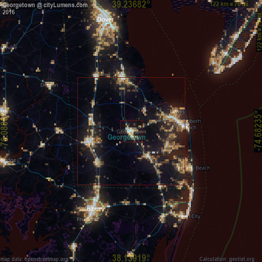
Analysis of Georgetown night lights 2016
Square area 10x10 km:
 3.23%
3.23%90-99
2.89%80-89
3.4%70-79
2.04%60-69
3.57%50-59
3.91%40-49
4.25%30-39
1.7%20-29
3.74%10-19
30.61%0-9
40.65%Square area 50x50 km:
0.77%90-99
1.01%80-89
1.91%70-79
2.29%60-69
2.15%50-59
2.42%40-49
2.75%30-39
3.66%20-29
4.85%10-19
15.6%0-9
62.59%Clear (daylight) street map image can be seen on geolist.org.
Map coordinates:
39° 14' 12.6" North, 76° 5' 19" West
38° 41' 24.4" North, 75° 23' 7.7" West
38° 8' 21.1" North, 74° 40' 56.5" West
Some cities around Georgetown sort by population:
• Dover
53.4 km =33.2 mi,  346°
346°
• Salisbury
41.1 km =25.5 mi,  206°
206°
• Ocean Pines
38.4 km =23.9 mi,  148°
148°
• Milford
25 km =15.5 mi, 351°
• Villas
54 km =33.6 mi,  45°
45°
• Seaford
20.3 km =12.6 mi,  254°
254°
• Ocean City
47.2 km =29.3 mi, 146°
• Fruitland
45.7 km =28.4 mi, 206°
4142643 (p: 7,051)
Sources (retrieved 2019-11-25):
» Earth at Night: Flat Maps 2012, 2016