Oberlin night lights from space
Night Light of Oberlin (Ohio) from space (United States) Src. Average luminocity for 10x10km area is 24.2078% and for 50x50km: 21.6778%.
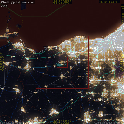
Analysis of Oberlin night lights 2016
Square area 10x10 km:
 1.46%
1.46%90-99
2.27%80-89
4.87%70-79
3.08%60-69
1.3%50-59
2.11%40-49
3.41%30-39
3.73%20-29
6.17%10-19
43.18%0-9
28.41%Square area 50x50 km:
2.59%90-99
4.35%80-89
3.25%70-79
2.78%60-69
5.26%50-59
2.63%40-49
2.15%30-39
2.83%20-29
5.09%10-19
7.92%0-9
61.14%Clear (daylight) street map image can be seen on geolist.org.
Map coordinates:
41° 49' 12.3" North, 82° 55' 13.8" West
41° 17' 38.2" North, 82° 13' 2.6" West
40° 45' 48.7" North, 81° 30' 51.3" West
Some cities around Oberlin sort by population:
• Lorain
17.9 km =11.1 mi,  9°
9°
• Elyria
12.3 km =7.6 mi,  47°
47°
• North Ridgeville
19.7 km =12.2 mi,  57°
57°
• Avon
23.2 km =14.4 mi,  40°
40°
• Amherst
11.6 km =7.2 mi,  357°
357°
• Vermilion-on-the-Lake
17.4 km =10.8 mi,  329°
329°
• Vermilion
18.8 km =11.7 mi,  319°
319°
• Grafton
13.8 km =8.6 mi,  99°
99°
5165445 (p: 8,350)
Sources (retrieved 2019-11-25):
» Earth at Night: Flat Maps 2012, 2016