Oakmont night lights from space
Night Light of Oakmont (Pennsylvania) from space (United States) Src. Average luminocity for 10x10km area is 66.2636% and for 50x50km: 49.6355%.
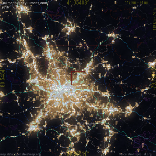
Analysis of Oakmont night lights 2016
Square area 10x10 km:
 9.01%
9.01%90-99
10.88%80-89
9.52%70-79
8.67%60-69
15.82%50-59
27.72%40-49
9.35%30-39
6.29%20-29
2.72%10-19
0%0-9
0%Square area 50x50 km:
8%90-99
9.23%80-89
6.35%70-79
7.46%60-69
9.91%50-59
10.76%40-49
8.39%30-39
5.85%20-29
7.88%10-19
9.07%0-9
17.1%Clear (daylight) street map image can be seen on geolist.org.
Map coordinates:
41° 3' 14.7" North, 80° 32' 43.4" West
40° 31' 18.2" North, 79° 50' 32.2" West
39° 59' 6.4" North, 79° 8' 20.9" West
Some cities around Oakmont sort by population:
• Penn Hills
2.3 km =1.4 mi,  173°
173°
• Plum
8.2 km =5.1 mi,  106°
106°
• Allison Park
10.7 km =6.6 mi,  293°
293°
• Wilkinsburg
9.5 km =5.9 mi,  200°
200°
• New Kensington
8.5 km =5.3 mi,  50°
50°
• Lower Burrell
8 km =5 mi,  64°
64°
• Glenshaw
10.7 km =6.6 mi,  276°
276°
• Fox Chapel
3.3 km =2.1 mi,  253°
253°
5204203 (p: 6,443)
Sources (retrieved 2019-11-25):
» Earth at Night: Flat Maps 2012, 2016