Lower Burrell night lights from space
Night Light of Lower Burrell (Pennsylvania) from space (United States) Src. Average luminocity for 10x10km area is 53.6136% and for 50x50km: 37.2403%.
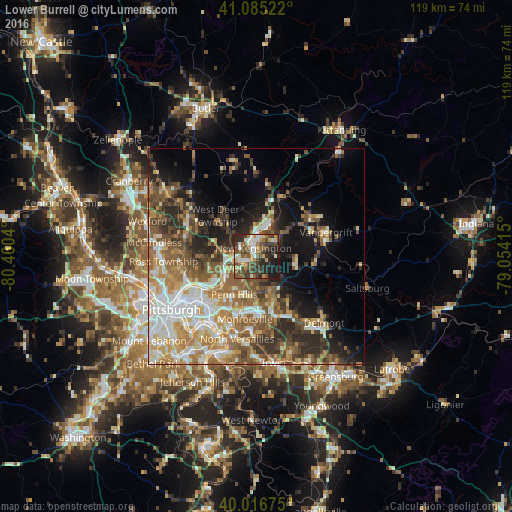
Analysis of Lower Burrell night lights 2016
Square area 10x10 km:
 6.98%
6.98%90-99
10.88%80-89
5.84%70-79
5.68%60-69
6.01%50-59
13.15%40-49
14.29%30-39
11.36%20-29
17.21%10-19
8.6%0-9
0%Square area 50x50 km:
6.11%90-99
6.81%80-89
4.57%70-79
5.39%60-69
6.39%50-59
6.85%40-49
6.42%30-39
5.18%20-29
7.54%10-19
10.09%0-9
34.64%Clear (daylight) street map image can be seen on geolist.org.
Map coordinates:
41° 5' 6.8" North, 80° 27' 37.4" West
40° 33' 11.2" North, 79° 45' 26.2" West
40° 1' 0.3" North, 79° 3' 14.9" West
Some cities around Lower Burrell sort by population:
• Penn Hills
9 km =5.6 mi,  230°
230°
• Monroeville
14.9 km =9.3 mi,  190°
190°
• Plum
5.9 km =3.7 mi,  173°
173°
• Murrysville
14.8 km =9.2 mi,  159°
159°
• Wilkinsburg
16.3 km =10.1 mi,  220°
220°
• New Kensington
2 km =1.2 mi,  341°
341°
• Oakmont
8 km =5 mi,  244°
244°
• Fox Chapel
11.3 km =7 mi,  246°
246°
5199087 (p: 11,761)
Sources (retrieved 2019-11-25):
» Earth at Night: Flat Maps 2012, 2016