New Kensington night lights from space
Night Light of New Kensington (Pennsylvania) from space (United States) Src. Average luminocity for 10x10km area is 56.3214% and for 50x50km: 36.0142%.
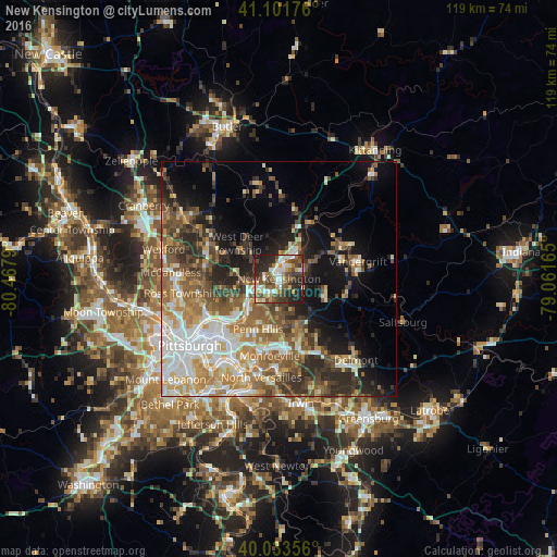
Analysis of New Kensington night lights 2016
Square area 10x10 km:
 9.74%
9.74%90-99
11.85%80-89
5.84%70-79
5.52%60-69
8.44%50-59
9.74%40-49
14.77%30-39
8.6%20-29
20.78%10-19
4.71%0-9
0%Square area 50x50 km:
6.02%90-99
6.66%80-89
4.31%70-79
5.08%60-69
5.89%50-59
6.55%40-49
6.14%30-39
5.14%20-29
7.5%10-19
10.29%0-9
36.42%Clear (daylight) street map image can be seen on geolist.org.
Map coordinates:
41° 6' 6.3" North, 80° 28' 4.4" West
40° 34' 11.2" North, 79° 45' 53.2" West
40° 2' 0.8" North, 79° 3' 41.9" West
Some cities around New Kensington sort by population:
• Penn Hills
9.9 km =6.2 mi,  219°
219°
• Monroeville
16.6 km =10.3 mi,  186°
186°
• Plum
7.8 km =4.8 mi,  170°
170°
• Allison Park
16.4 km =10.2 mi,  266°
266°
• Murrysville
16.7 km =10.4 mi,  160°
160°
• Lower Burrell
2 km =1.2 mi, 161°
• Oakmont
8.5 km =5.3 mi,  230°
230°
• Fox Chapel
11.6 km =7.2 mi,  237°
237°
5203211 (p: 12,713)
Sources (retrieved 2019-11-25):
» Earth at Night: Flat Maps 2012, 2016