Norwalk night lights from space
Night Light of Norwalk (Connecticut) from space (United States) Src. Average luminocity for 10x10km area is 64.2565% and for 50x50km: 25.8073%.
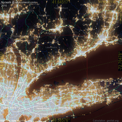
Analysis of Norwalk night lights 2016
Square area 10x10 km:
 11.85%
90-99
11.2%80-89
11.36%70-79
10.71%60-69
6.82%50-59
16.4%40-49
14.61%30-39
2.92%20-29
9.25%10-19
4.71%0-9
0.16%Square area 50x50 km:
2.89%90-99
2.9%80-89
3%70-79
3.24%60-69
4.39%50-59
5.54%40-49
4.88%30-39
5.05%20-29
8.29%10-19
16%0-9
43.82%Clear (daylight) street map image can be seen on geolist.org.
Map coordinates:
41° 38' 42.6" North, 74° 6' 39.7" West
41° 7' 3.4" North, 73° 24' 28.4" West
40° 35' 8.7" North, 72° 42' 17.2" West
Some cities around Norwalk sort by population:
• Stamford
13.1 km =8.1 mi,  236°
236°
• North Stamford
11.6 km =7.2 mi,  281°
281°
• East Norwalk
1.5 km =0.9 mi,  149°
149°
• Fairfield
12.4 km =7.7 mi,  77°
77°
• Westport
5 km =3.1 mi,  57°
57°
• Darien
6.7 km =4.2 mi,  229°
229°
• New Canaan
8 km =5 mi,  294°
294°
• Wilton
9 km =5.6 mi,  343°
343°
4839822 (p: 88,485)
Sources (retrieved 2019-11-25):
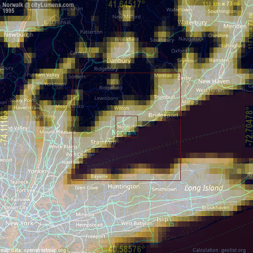
» NASA, Earths city lights 1995
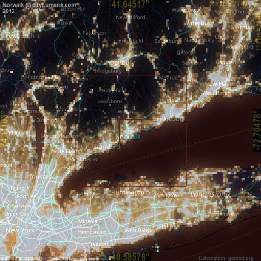
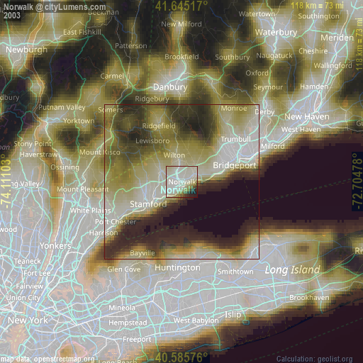
» NASA city lights 2003
» Earth at Night: Flat Maps 2012, 2016