North Stamford night lights from space
Night Light of North Stamford (Connecticut) from space (United States) Src. Average luminocity for 10x10km area is 34.9286% and for 50x50km: 29.6301%.
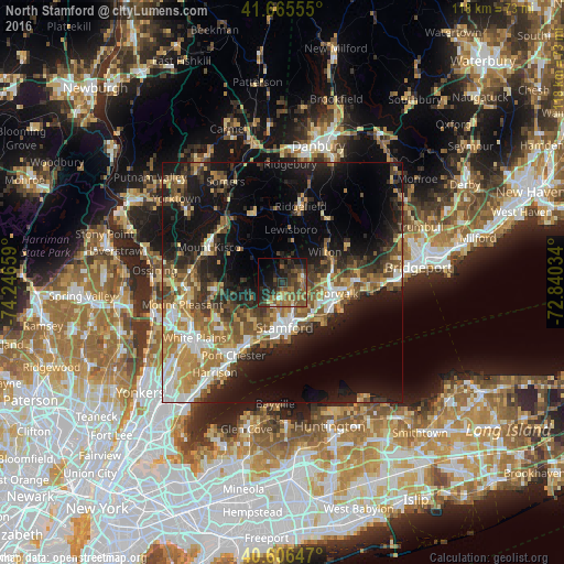
Analysis of North Stamford night lights 2016
Square area 10x10 km:
 0.81%
0.81%90-99
1.14%80-89
2.44%70-79
5.68%60-69
8.12%50-59
11.53%40-49
10.06%30-39
11.69%20-29
15.42%10-19
16.07%0-9
17.05%Square area 50x50 km:
3.55%90-99
3.99%80-89
3.59%70-79
4.67%60-69
5.21%50-59
5.24%40-49
4.66%30-39
4.97%20-29
8.35%10-19
17.84%0-9
37.93%Clear (daylight) street map image can be seen on geolist.org.
Map coordinates:
41° 39' 56" North, 74° 14' 47.7" West
41° 8' 17.3" North, 73° 32' 36.5" West
40° 36' 23.3" North, 72° 50' 25.2" West
Some cities around North Stamford sort by population:
• Stamford
9.4 km =5.8 mi,  177°
177°
• Norwalk
11.6 km =7.2 mi,  101°
101°
• Darien
9.1 km =5.7 mi,  136°
136°
• New Canaan
4.2 km =2.6 mi,  76°
76°
• Wilton
10.9 km =6.8 mi,  54°
54°
• Riverside
12 km =7.5 mi,  194°
194°
• Cos Cob
12.6 km =7.8 mi,  201°
201°
• Pound Ridge
8.3 km =5.2 mi,  341°
341°
4839745 (p: 121,230)
Sources (retrieved 2019-11-25):
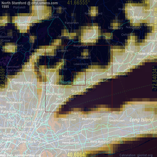
» NASA, Earths city lights 1995
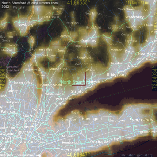
» NASA city lights 2003
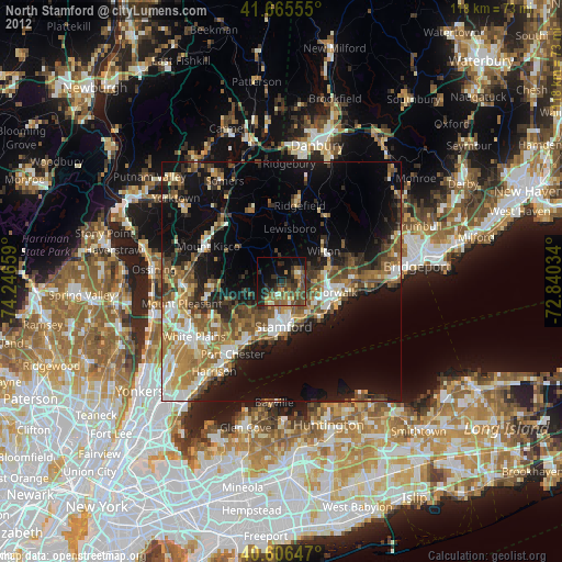
» Earth at Night: Flat Maps 2012, 2016