Darien night lights from space
Night Light of Darien (Connecticut) from space (United States) Src. Average luminocity for 10x10km area is 60.3036% and for 50x50km: 30.5519%.
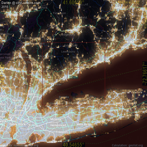
Analysis of Darien night lights 2016
Square area 10x10 km:
 12.66%
90-99
10.55%80-89
6.49%70-79
6.17%60-69
11.04%50-59
21.43%40-49
8.12%30-39
2.44%20-29
10.55%10-19
9.42%0-9
1.14%Square area 50x50 km:
3.25%90-99
3.86%80-89
3.56%70-79
4.16%60-69
5.92%50-59
6.97%40-49
5.48%30-39
5.81%20-29
9.32%10-19
15.77%0-9
35.9%Clear (daylight) street map image can be seen on geolist.org.
Map coordinates:
41° 36' 23.7" North, 74° 10' 20.7" West
41° 4' 43.4" North, 73° 28' 9.4" West
40° 32' 47.6" North, 72° 45' 58.2" West
Some cities around Darien sort by population:
• Stamford
6.5 km =4 mi,  244°
244°
• North Stamford
9.1 km =5.7 mi,  316°
316°
• Norwalk
6.7 km =4.2 mi,  49°
49°
• East Norwalk
6.6 km =4.1 mi,  63°
63°
• Westport
11.7 km =7.3 mi, 53°
• New Canaan
7.9 km =4.9 mi,  344°
344°
• Riverside
10.4 km =6.5 mi, 241°
• Old Greenwich
10.1 km =6.3 mi,  232°
232°
4832425 (p: 20,732)
Sources (retrieved 2019-11-25):
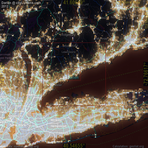
» Earth at Night: Flat Maps 2012, 2016