Wilton night lights from space
Night Light of Wilton (Connecticut) from space (United States) Src. Average luminocity for 10x10km area is 25.776% and for 50x50km: 27.1381%.
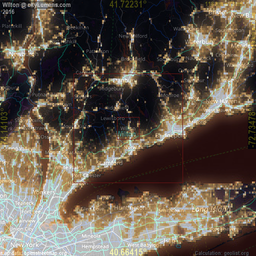
Analysis of Wilton night lights 2016
Square area 10x10 km:
 0.49%
0.49%90-99
1.46%80-89
0.97%70-79
3.57%60-69
3.41%50-59
5.84%40-49
7.79%30-39
7.95%20-29
14.61%10-19
24.84%0-9
29.06%Square area 50x50 km:
3.34%90-99
3.61%80-89
2.97%70-79
3.26%60-69
5.01%50-59
5.19%40-49
4.62%30-39
5.14%20-29
8.2%10-19
16.65%0-9
42.01%Clear (daylight) street map image can be seen on geolist.org.
Map coordinates:
41° 43' 20.3" North, 74° 8' 27.7" West
41° 11' 43.3" North, 73° 26' 16.4" West
40° 39' 50.9" North, 72° 44' 5.2" West
Some cities around Wilton sort by population:
• North Stamford
10.9 km =6.8 mi,  234°
234°
• Norwalk
9 km =5.6 mi,  163°
163°
• East Norwalk
10.5 km =6.5 mi, 161°
• Westport
9 km =5.6 mi,  131°
131°
• Darien
13.2 km =8.2 mi,  191°
191°
• New Canaan
7.2 km =4.5 mi,  221°
221°
• Ridgefield
10.8 km =6.7 mi,  332°
332°
• Pound Ridge
11.6 km =7.2 mi,  277°
277°
4845871 (p: 18,062)
Sources (retrieved 2019-11-25):
» Earth at Night: Flat Maps 2012, 2016