Fairfield night lights from space
Night Light of Fairfield (Connecticut) from space (United States) Src. Average luminocity for 10x10km area is 44.0974% and for 50x50km: 25.927%.
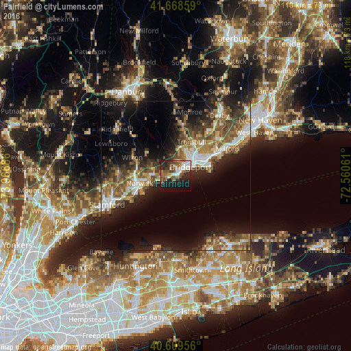
Analysis of Fairfield night lights 2016
Square area 10x10 km:
 7.95%
7.95%90-99
7.14%80-89
2.44%70-79
3.41%60-69
9.09%50-59
9.74%40-49
8.28%30-39
8.28%20-29
12.66%10-19
22.73%0-9
8.28%Square area 50x50 km:
3.33%90-99
3.46%80-89
2.83%70-79
3.22%60-69
4.3%50-59
5.9%40-49
4.78%30-39
4.39%20-29
7.65%10-19
13.71%0-9
46.45%Clear (daylight) street map image can be seen on geolist.org.
Map coordinates:
41° 40' 6.9" North, 73° 58' 0.7" West
41° 8' 28.4" North, 73° 15' 49.4" West
40° 36' 34.4" North, 72° 33' 38.2" West
Some cities around Fairfield sort by population:
• Bridgeport
7.5 km =4.7 mi,  55°
55°
• Norwalk
12.4 km =7.7 mi,  257°
257°
• East Norwalk
12 km =7.5 mi,  250°
250°
• Stratford
11.9 km =7.4 mi,  66°
66°
• Trumbull
12.5 km =7.8 mi,  25°
25°
• Westport
7.9 km =4.9 mi,  270°
270°
• Wilton
15.8 km =9.8 mi,  292°
292°
• Easton
12.7 km =7.9 mi,  347°
347°
4834157 (p: 59,052)
Sources (retrieved 2019-11-25):
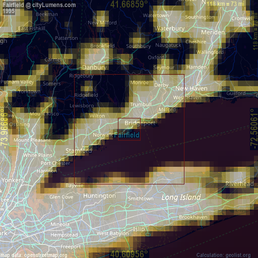
» NASA, Earths city lights 1995
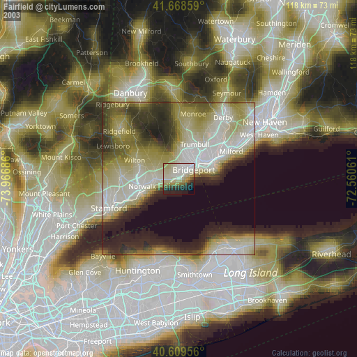
» NASA city lights 2003
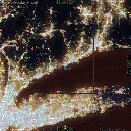
» Earth at Night: Flat Maps 2012, 2016