East Islip night lights from space
Night Light of East Islip (New York) from space (United States) Src. Average luminocity for 10x10km area is 57.388% and for 50x50km: 40.2709%.
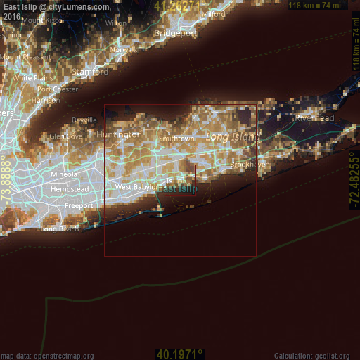
Analysis of East Islip night lights 2016
Square area 10x10 km:
 8.44%
8.44%90-99
9.58%80-89
12.5%70-79
10.88%60-69
6.33%50-59
10.55%40-49
10.88%30-39
3.08%20-29
13.8%10-19
12.99%0-9
0.97%Square area 50x50 km:
7.36%90-99
8.82%80-89
6.12%70-79
8.51%60-69
7.55%50-59
5.71%40-49
3.39%30-39
2.58%20-29
5.09%10-19
6.39%0-9
38.49%Clear (daylight) street map image can be seen on geolist.org.
Map coordinates:
41° 15' 45.8" North, 73° 53' 19.7" West
40° 43' 55.3" North, 73° 11' 8.4" West
40° 11' 49.6" North, 72° 28' 57.2" West
Some cities around East Islip sort by population:
• Central Islip
6.7 km =4.2 mi,  348°
348°
• Bay Shore
5.1 km =3.2 mi,  261°
261°
• North Bay Shore
6.5 km =4 mi,  274°
274°
• Islip
2.1 km =1.3 mi, 263°
• Bohemia
7.2 km =4.5 mi,  55°
55°
• Oakdale
4.2 km =2.6 mi,  71°
71°
• Islip Terrace
1.4 km =0.9 mi,  334°
334°
• West Sayville
7.4 km =4.6 mi,  93°
93°
5115923 (p: 14,475)
Sources (retrieved 2019-11-25):
» Earth at Night: Flat Maps 2012, 2016