North Arlington night lights from space
Night Light of North Arlington (New Jersey) from space (United States) Src. Average luminocity for 10x10km area is 95.9886% and for 50x50km: 86.4133%.
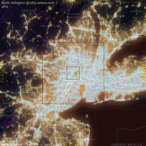
Analysis of North Arlington night lights 2016
Square area 10x10 km:
 55.52%
90-99
28.08%80-89
8.12%70-79
8.28%60-69
0%50-59
0%40-49
0%30-39
0%20-29
0%10-19
0%0-9
0%Square area 50x50 km:
41.97%90-99
20.21%80-89
8.41%70-79
10.47%60-69
8.82%50-59
3.89%40-49
2.3%30-39
1.79%20-29
1.08%10-19
0.77%0-9
0.3%Clear (daylight) street map image can be seen on geolist.org.
Map coordinates:
41° 19' 7.1" North, 74° 50' 10.8" West
40° 47' 18.3" North, 74° 7' 59.5" West
40° 15' 14.2" North, 73° 25' 48.3" West
Some cities around North Arlington sort by population:
• Bloomfield
4.8 km =3 mi,  294°
294°
• Kearny
2.5 km =1.6 mi,  204°
204°
• Belleville
1.5 km =0.9 mi, 292°
• Nutley
4.4 km =2.7 mi,  329°
329°
• Lyndhurst
2.7 km =1.7 mi,  15°
15°
• Rutherford
4.8 km =3 mi,  27°
27°
• Harrison
5.1 km =3.2 mi, 202°
• East Rutherford
5.9 km =3.7 mi, 30°
5101873 (p: 15,904)
Sources (retrieved 2019-11-25):
» Earth at Night: Flat Maps 2012, 2016