Rutherford night lights from space
Night Light of Rutherford (New Jersey) from space (United States) Src. Average luminocity for 10x10km area is 98.4473% and for 50x50km: 85.7522%.
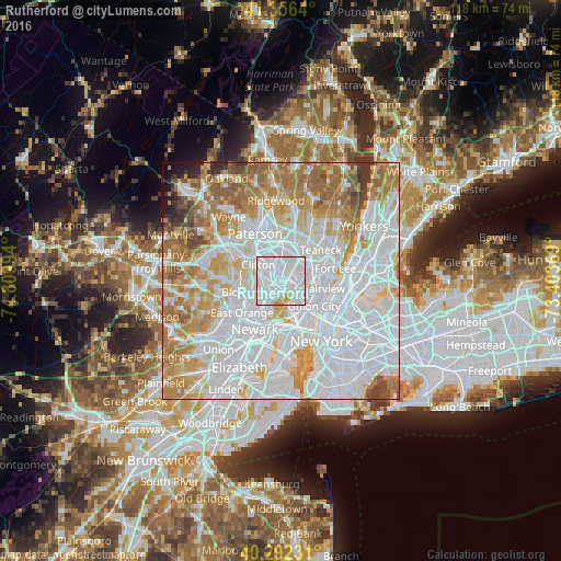
Analysis of Rutherford night lights 2016
Square area 10x10 km:
 72.79%
90-99
21.77%80-89
1.87%70-79
3.57%60-69
0%50-59
0%40-49
0%30-39
0%20-29
0%10-19
0%0-9
0%Square area 50x50 km:
41.48%90-99
18.92%80-89
7.84%70-79
10.37%60-69
10.82%50-59
4.79%40-49
2.18%30-39
1.7%20-29
0.94%10-19
0.82%0-9
0.14%Clear (daylight) street map image can be seen on geolist.org.
Map coordinates:
41° 21' 23" North, 74° 48' 35.8" West
40° 49' 35.4" North, 74° 6' 24.5" West
40° 17' 32.3" North, 73° 24' 13.3" West
Some cities around Rutherford sort by population:
• Passaic
3.8 km =2.4 mi,  331°
331°
• Nutley
4.5 km =2.8 mi,  264°
264°
• Lyndhurst
2.2 km =1.4 mi,  222°
222°
• Hasbrouck Heights
4.2 km =2.6 mi,  31°
31°
• Wallington
3 km =1.9 mi,  348°
348°
• East Rutherford
1.2 km =0.7 mi,  44°
44°
• Wood-Ridge
2.7 km =1.7 mi, 36°
• Carlstadt
2.1 km =1.3 mi, 41°
5103580 (p: 18,690)
Sources (retrieved 2019-11-25):
» Earth at Night: Flat Maps 2012, 2016