East Rutherford night lights from space
Night Light of East Rutherford (New Jersey) from space (United States) Src. Average luminocity for 10x10km area is 98.4082% and for 50x50km: 85.8301%.
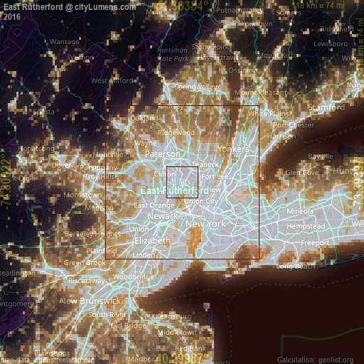
Analysis of East Rutherford night lights 2016
Square area 10x10 km:
 73.13%
90-99
20.07%80-89
4.59%70-79
2.21%60-69
0%50-59
0%40-49
0%30-39
0%20-29
0%10-19
0%0-9
0%Square area 50x50 km:
41.47%90-99
18.99%80-89
7.9%70-79
10.39%60-69
10.7%50-59
4.86%40-49
2.15%30-39
1.74%20-29
0.99%10-19
0.72%0-9
0.08%Clear (daylight) street map image can be seen on geolist.org.
Map coordinates:
41° 21' 49.8" North, 74° 48' 0.8" West
40° 50' 2.4" North, 74° 5' 49.5" West
40° 17' 59.5" North, 73° 23' 38.3" West
Some cities around East Rutherford sort by population:
• Passaic
3.7 km =2.3 mi,  313°
313°
• Lyndhurst
3.3 km =2.1 mi,  223°
223°
• Rutherford
1.2 km =0.7 mi, 224°
• Hasbrouck Heights
3 km =1.9 mi,  27°
27°
• Wallington
2.6 km =1.6 mi,  326°
326°
• Little Ferry
5.1 km =3.2 mi,  65°
65°
• Wood-Ridge
1.5 km =0.9 mi, 30°
• Carlstadt
0.9 km =0.6 mi,  37°
37°
5097459 (p: 9,164)
Sources (retrieved 2019-11-25):
» Earth at Night: Flat Maps 2012, 2016