Normal night lights from space
Night Light of Normal (Illinois) from space (United States) Src. Average luminocity for 10x10km area is 82.966% and for 50x50km: 9.1343%.
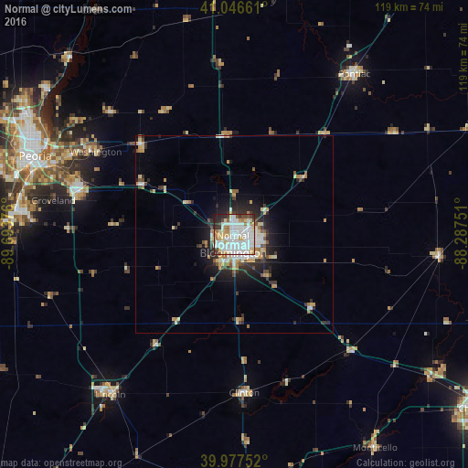

Analysis of Normal night lights 2016
Square area 10x10 km:
 30.95%
90-99
29.42%80-89
12.41%70-79
4.42%60-69
4.93%50-59
2.55%40-49
4.93%30-39
3.23%20-29
6.12%10-19
1.02%0-9
0%Square area 50x50 km:
1.71%90-99
1.78%80-89
1.55%70-79
1.03%60-69
0.81%50-59
0.74%40-49
0.9%30-39
1.2%20-29
2.61%10-19
4%0-9
83.66%Clear (daylight) street map image can be seen on geolist.org.
Map coordinates:
41° 2' 47.8" North, 89° 41' 37.5" West
40° 30' 51.1" North, 88° 59' 26.3" West
39° 58' 39.1" North, 88° 17' 15" West
Some cities around Normal sort by population:
• Bloomington
3.3 km =2.1 mi,  184°
184°
• East Peoria
52.6 km =32.7 mi,  288°
288°
• Washington
41 km =25.5 mi,  300°
300°
• Morton
41.1 km =25.5 mi, 285°
• Lincoln
51.6 km =32.1 mi,  217°
217°
• Pontiac
50.9 km =31.6 mi,  36°
36°
• Clinton
40.2 km =25 mi, 176°
• Eureka
33.1 km =20.6 mi,  314°
314°
4903780 (p: 54,373)
Sources (retrieved 2019-11-25):
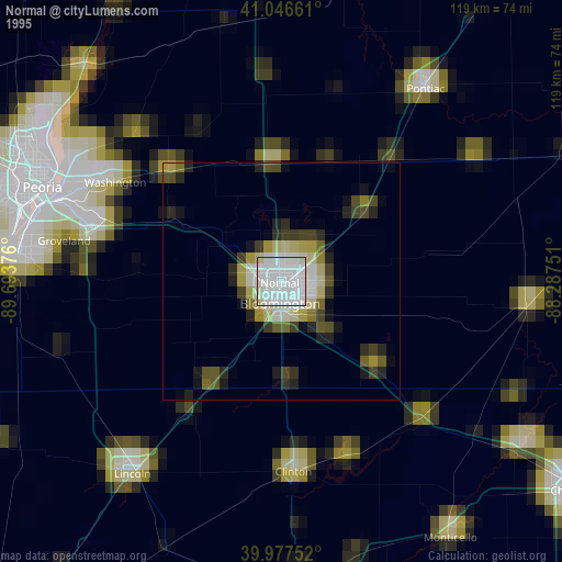
» NASA, Earths city lights 1995
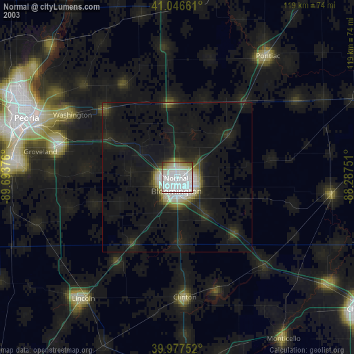
» NASA city lights 2003
» Earth at Night: Flat Maps 2012, 2016