Clinton night lights from space
Night Light of Clinton (Maryland) from space (United States) Src. Average luminocity for 10x10km area is 75.3333% and for 50x50km: 54.4434%.
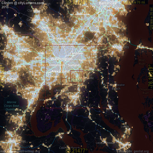
Analysis of Clinton night lights 2016
Square area 10x10 km:
 8.67%
8.67%90-99
13.44%80-89
19.73%70-79
22.11%60-69
15.65%50-59
15.31%40-49
4.08%30-39
1.02%20-29
0%10-19
0%0-9
0%Square area 50x50 km:
17.49%90-99
11.01%80-89
7.73%70-79
8.28%60-69
6.16%50-59
5.22%40-49
3.89%30-39
5.35%20-29
5.96%10-19
7.48%0-9
21.43%Clear (daylight) street map image can be seen on geolist.org.
Map coordinates:
39° 18' 40.5" North, 77° 36' 5.2" West
38° 45' 54.4" North, 76° 53' 53.9" West
38° 12' 53.2" North, 76° 11' 42.7" West
Some cities around Clinton sort by population:
• Oxon Hill-Glassmanor
7.5 km =4.7 mi,  297°
297°
• Camp Springs
4.4 km =2.7 mi,  350°
350°
• Oxon Hill
9 km =5.6 mi, 298°
• Rosaryville
7.7 km =4.8 mi,  96°
96°
• Friendly
7.1 km =4.4 mi,  257°
257°
• Temple Hills
6.8 km =4.2 mi,  323°
323°
• Brandywine
8.8 km =5.5 mi,  150°
150°
• Marlow Heights
8.9 km =5.5 mi,  328°
328°
4351871 (p: 35,970)
Sources (retrieved 2019-11-25):
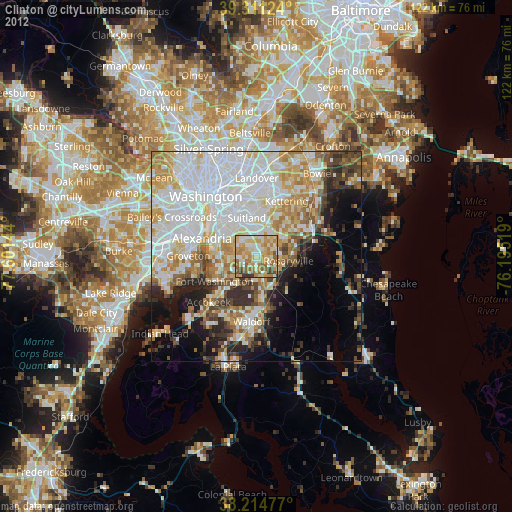
» Earth at Night: Flat Maps 2012, 2016