Murrysville night lights from space
Night Light of Murrysville (Pennsylvania) from space (United States) Src. Average luminocity for 10x10km area is 51.9575% and for 50x50km: 39.8306%.
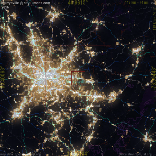
Analysis of Murrysville night lights 2016
Square area 10x10 km:
 4.76%
4.76%90-99
6.12%80-89
6.63%70-79
6.12%60-69
9.69%50-59
16.5%40-49
13.1%30-39
13.61%20-29
18.54%10-19
4.76%0-9
0.17%Square area 50x50 km:
5.48%90-99
6.21%80-89
4.83%70-79
5.44%60-69
7.56%50-59
8.05%40-49
7.46%30-39
6.49%20-29
11.6%10-19
14.62%0-9
22.26%Clear (daylight) street map image can be seen on geolist.org.
Map coordinates:
40° 57' 41.4" North, 80° 24' 2.4" West
40° 25' 42.2" North, 79° 41' 51.2" West
39° 53' 27.7" North, 78° 59' 39.9" West
Some cities around Murrysville sort by population:
• Penn Hills
14.5 km =9 mi,  304°
304°
• Monroeville
7.7 km =4.8 mi,  264°
264°
• Plum
9.1 km =5.7 mi,  331°
331°
• North Versailles
10.9 km =6.8 mi,  240°
240°
• Jeannette
13.1 km =8.1 mi,  148°
148°
• White Oak
13.8 km =8.6 mi,  223°
223°
• Forest Hills
12.9 km =8 mi,  265°
265°
• Turtle Creek
11.1 km =6.9 mi, 256°
5202765 (p: 20,134)
Sources (retrieved 2019-11-25):
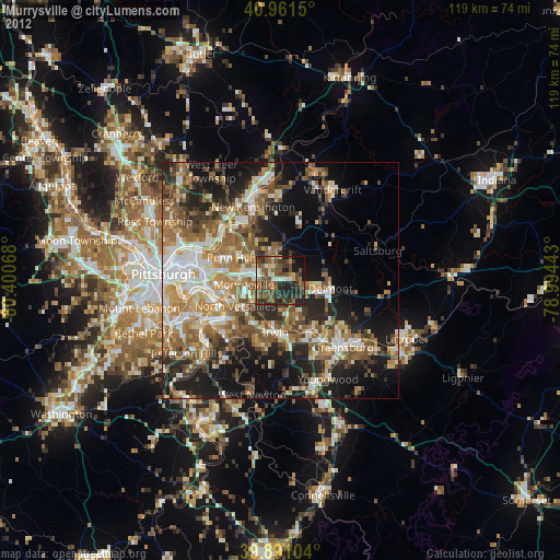
» Earth at Night: Flat Maps 2012, 2016