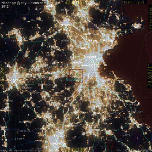
Needham night lights from space
Night Light of Needham (Massachusetts) from space (United States) Src. Average luminocity for 10x10km area is 61.8136% and for 50x50km: 56.8341%.
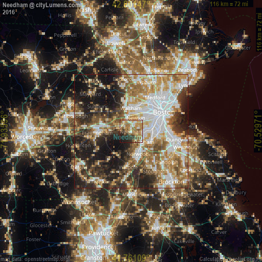
Analysis of Needham night lights 2016
Square area 10x10 km:
 7.88%
7.88%90-99
10.15%80-89
9.85%70-79
12.73%60-69
20.15%50-59
9.7%40-49
5.3%30-39
6.67%20-29
11.52%10-19
6.06%0-9
0%Square area 50x50 km:
13.26%90-99
12.2%80-89
6.51%70-79
7.37%60-69
8.52%50-59
8.11%40-49
7.3%30-39
7.14%20-29
11.69%10-19
14.8%0-9
3.09%Clear (daylight) street map image can be seen on geolist.org.
Map coordinates:
42° 48' 5.3" North, 71° 56' 9.5" West
42° 17' 0.3" North, 71° 13' 58.2" West
41° 45' 39.9" North, 70° 31' 47" West
Some cities around Needham sort by population:
• Newton
6.3 km =3.9 mi,  18°
18°
• Waltham
10.3 km =6.4 mi,  358°
358°
• Jamaica Plain
9.7 km =6 mi,  72°
72°
• Natick
9.6 km =6 mi,  270°
270°
• Norwood
10.3 km =6.4 mi,  164°
164°
• Wellesley
5.1 km =3.2 mi,  286°
286°
• Dedham
7.2 km =4.5 mi,  130°
130°
• Westwood
7.8 km =4.8 mi,  174°
174°
4945055 (p: 28,886)
Sources (retrieved 2019-11-25):
» Earth at Night: Flat Maps 2012, 2016