Murray night lights from space
Night Light of Murray (Kentucky) from space (United States) Src. Average luminocity for 10x10km area is 40.2729% and for 50x50km: 2.5574%.
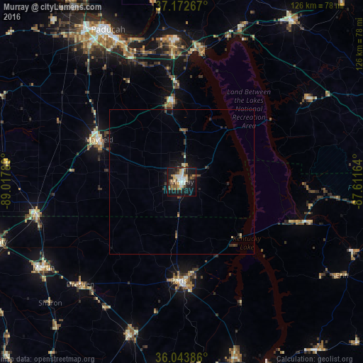
Analysis of Murray night lights 2016
Square area 10x10 km:
 6.96%
6.96%90-99
6.23%80-89
6.41%70-79
4.21%60-69
6.23%50-59
5.86%40-49
4.58%30-39
5.31%20-29
7.51%10-19
38.1%0-9
8.61%Square area 50x50 km:
0.27%90-99
0.26%80-89
0.34%70-79
0.25%60-69
0.27%50-59
0.38%40-49
0.4%30-39
0.61%20-29
0.54%10-19
2.2%0-9
94.48%Clear (daylight) street map image can be seen on geolist.org.
Map coordinates:
37° 10' 21.6" North, 89° 1' 4.4" West
36° 36' 37.2" North, 88° 18' 53.1" West
36° 2' 37.9" North, 87° 36' 41.9" West
Some cities around Murray sort by population:
• Paducah
58.4 km =36.3 mi,  334°
334°
• Martin
56.3 km =35 mi,  238°
238°
• Union City
69.5 km =43.2 mi,  252°
252°
• Paris
34.3 km =21.3 mi,  181°
181°
• Mayfield
32.2 km =20 mi,  296°
296°
• Metropolis
70.7 km =43.9 mi, 328°
• Princeton
67.5 km =41.9 mi,  34°
34°
• McKenzie
56.2 km =34.9 mi,  198°
198°
4302035 (p: 18,954)
Sources (retrieved 2019-11-25):
» Earth at Night: Flat Maps 2012, 2016