Union City night lights from space
Night Light of Union City (Tennessee) from space (United States) Src. Average luminocity for 10x10km area is 38.7955% and for 50x50km: 5.8478%.
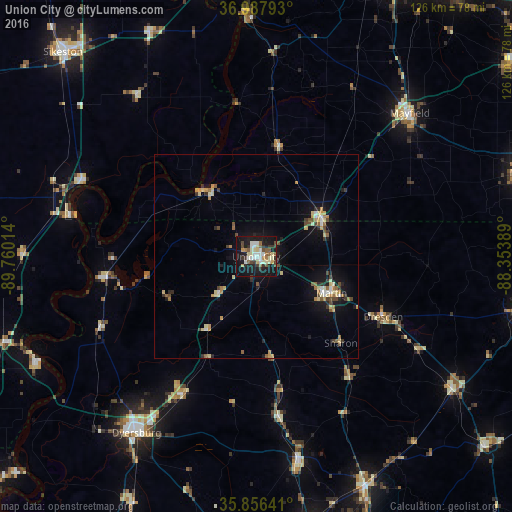
Analysis of Union City night lights 2016
Square area 10x10 km:
 5.94%
5.94%90-99
9.27%80-89
5.94%70-79
2.62%60-69
2.8%50-59
5.94%40-49
4.02%30-39
6.47%20-29
5.24%10-19
43.71%0-9
8.04%Square area 50x50 km:
0.43%90-99
0.73%80-89
1.08%70-79
0.78%60-69
0.62%50-59
0.72%40-49
0.81%30-39
0.82%20-29
0.74%10-19
4.61%0-9
88.66%Clear (daylight) street map image can be seen on geolist.org.
Map coordinates:
36° 59' 16.5" North, 89° 45' 36.5" West
36° 25' 27.2" North, 89° 3' 25.2" West
35° 51' 23.1" North, 88° 21' 14" West
Some cities around Union City sort by population:
• Dyersburg
52.4 km =32.6 mi,  214°
214°
• Martin
20.6 km =12.8 mi,  115°
115°
• Paris
66.8 km =41.5 mi,  101°
101°
• Mayfield
51.5 km =32 mi,  46°
46°
• Milan
62.1 km =38.6 mi,  154°
154°
• Caruthersville
59.5 km =37 mi,  244°
244°
• Charleston
61.1 km =38 mi,  334°
334°
• McKenzie
58.1 km =36.1 mi, 123°
4664170 (p: 10,573)
Sources (retrieved 2019-11-25):
» Earth at Night: Flat Maps 2012, 2016