Mayfield night lights from space
Night Light of Mayfield (Kentucky) from space (United States) Src. Average luminocity for 10x10km area is 33.451% and for 50x50km: 3.0434%.
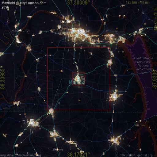
Analysis of Mayfield night lights 2016
Square area 10x10 km:
 3.67%
3.67%90-99
5.24%80-89
6.64%70-79
3.85%60-69
6.12%50-59
3.15%40-49
4.2%30-39
2.8%20-29
5.94%10-19
38.46%0-9
19.93%Square area 50x50 km:
0.17%90-99
0.24%80-89
0.42%70-79
0.33%60-69
0.39%50-59
0.29%40-49
0.39%30-39
0.93%20-29
0.59%10-19
2.61%0-9
93.64%Clear (daylight) street map image can be seen on geolist.org.
Map coordinates:
37° 18' 11.1" North, 89° 20' 23.5" West
36° 44' 30.2" North, 88° 38' 12.2" West
36° 10' 34.4" North, 87° 56' 1" West
Some cities around Mayfield sort by population:
• Paducah
38.1 km =23.7 mi,  4°
4°
• Murray
32.2 km =20 mi,  116°
116°
• Martin
48.2 km =30 mi,  203°
203°
• Union City
51.5 km =32 mi,  226°
226°
• Paris
56.2 km =34.9 mi,  150°
150°
• Metropolis
46.3 km =28.8 mi,  349°
349°
• Charleston
66.6 km =41.4 mi,  287°
287°
• McKenzie
68.6 km =42.6 mi,  171°
171°
4300105 (p: 10,080)
Sources (retrieved 2019-11-25):
» Earth at Night: Flat Maps 2012, 2016