McKenzie night lights from space
Night Light of McKenzie (Tennessee) from space (United States) Src. Average luminocity for 10x10km area is 19.9377% and for 50x50km: 5.9625%.
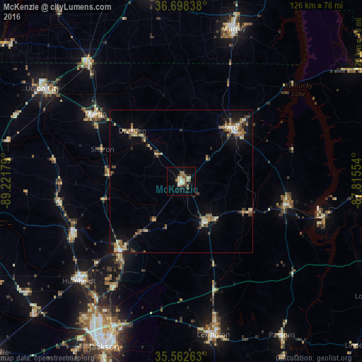
Analysis of McKenzie night lights 2016
Square area 10x10 km:
 0.37%
0.37%90-99
4.58%80-89
3.11%70-79
0.92%60-69
3.48%50-59
5.86%40-49
0.73%30-39
2.2%20-29
3.85%10-19
8.97%0-9
65.93%Square area 50x50 km:
0.24%90-99
0.79%80-89
1.03%70-79
0.54%60-69
0.73%50-59
1.4%40-49
0.77%30-39
1.14%20-29
0.66%10-19
3.68%0-9
89.01%Clear (daylight) street map image can be seen on geolist.org.
Map coordinates:
36° 41' 54.2" North, 89° 13' 18.4" West
36° 7' 57.2" North, 88° 31' 7.2" West
35° 33' 45.5" North, 87° 48' 55.9" West
Some cities around McKenzie sort by population:
• Jackson
63.4 km =39.4 mi,  204°
204°
• Murray
56.2 km =34.9 mi,  18°
18°
• Martin
37.9 km =23.5 mi,  308°
308°
• Union City
58.1 km =36.1 mi,  303°
303°
• Paris
25.5 km =15.8 mi,  42°
42°
• Humboldt
49.9 km =31 mi,  225°
225°
• Lexington
54.7 km =34 mi,  168°
168°
• Milan
32 km =19.9 mi,  222°
222°
4640736 (p: 5,296)
Sources (retrieved 2019-11-25):
» Earth at Night: Flat Maps 2012, 2016