Mountainside night lights from space
Night Light of Mountainside (New Jersey) from space (United States) Src. Average luminocity for 10x10km area is 81.3653% and for 50x50km: 73.7833%.
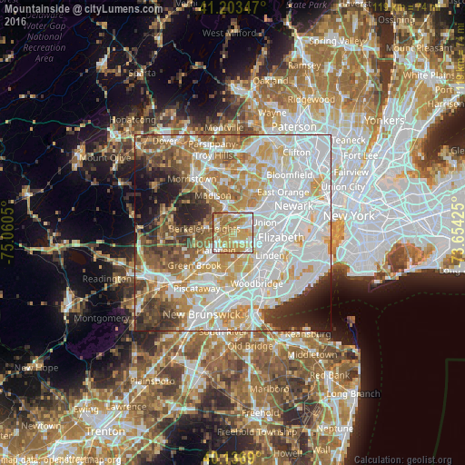
Analysis of Mountainside night lights 2016
Square area 10x10 km:
 15.26%
90-99
15.26%80-89
20.94%70-79
25.65%60-69
21.27%50-59
1.62%40-49
0%30-39
0%20-29
0%10-19
0%0-9
0%Square area 50x50 km:
26.68%90-99
17.51%80-89
8.35%70-79
10.64%60-69
8.59%50-59
6.29%40-49
5.38%30-39
4.89%20-29
5.15%10-19
4.73%0-9
1.8%Clear (daylight) street map image can be seen on geolist.org.
Map coordinates:
41° 12' 12.5" North, 75° 3' 37.8" West
40° 40' 20.4" North, 74° 21' 26.5" West
40° 8' 12.8" North, 73° 39' 15.3" West
Some cities around Mountainside sort by population:
• Westfield
1.7 km =1.1 mi,  150°
150°
• Scotch Plains
3.3 km =2.1 mi,  235°
235°
• Cranford
5.1 km =3.2 mi,  107°
107°
• Summit
4.9 km =3 mi,  352°
352°
• Clark
5.3 km =3.3 mi,  131°
131°
• Springfield
5 km =3.1 mi,  43°
43°
• New Providence
4.7 km =2.9 mi,  307°
307°
• Fanwood
4.1 km =2.5 mi,  212°
212°
5101601 (p: 6,885)
Sources (retrieved 2019-11-25):
» Earth at Night: Flat Maps 2012, 2016