Summit night lights from space
Night Light of Summit (New Jersey) from space (United States) Src. Average luminocity for 10x10km area is 77.5779% and for 50x50km: 74.7495%.
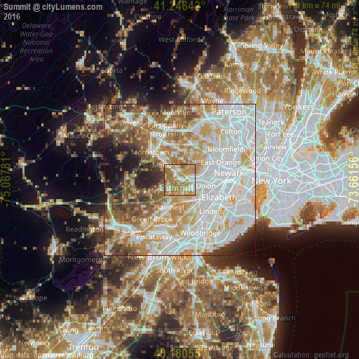
Analysis of Summit night lights 2016
Square area 10x10 km:
 12.99%
90-99
12.01%80-89
15.26%70-79
22.89%60-69
30.36%50-59
5.84%40-49
0.65%30-39
0%20-29
0%10-19
0%0-9
0%Square area 50x50 km:
27.03%90-99
17.8%80-89
8.48%70-79
10.65%60-69
8.71%50-59
6.87%40-49
5.86%30-39
4.43%20-29
4.5%10-19
4.15%0-9
1.53%Clear (daylight) street map image can be seen on geolist.org.
Map coordinates:
41° 14' 47.1" North, 75° 4' 4.1" West
40° 42' 56.2" North, 74° 21' 52.8" West
40° 10' 50" North, 73° 39' 41.6" West
Some cities around Summit sort by population:
• Westfield
6.5 km =4 mi,  166°
166°
• Scotch Plains
7 km =4.3 mi,  197°
197°
• Madison
6.6 km =4.1 mi,  318°
318°
• Springfield
4.2 km =2.6 mi,  106°
106°
• Short Hills
4.9 km =3 mi,  42°
42°
• New Providence
3.6 km =2.2 mi,  238°
238°
• Chatham
3.2 km =2 mi,  330°
330°
• Mountainside
4.9 km =3 mi, 172°
5105127 (p: 22,074)
Sources (retrieved 2019-11-25):
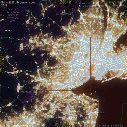
» Earth at Night: Flat Maps 2012, 2016