Fanwood night lights from space
Night Light of Fanwood (New Jersey) from space (United States) Src. Average luminocity for 10x10km area is 80.0373% and for 50x50km: 71.3526%.
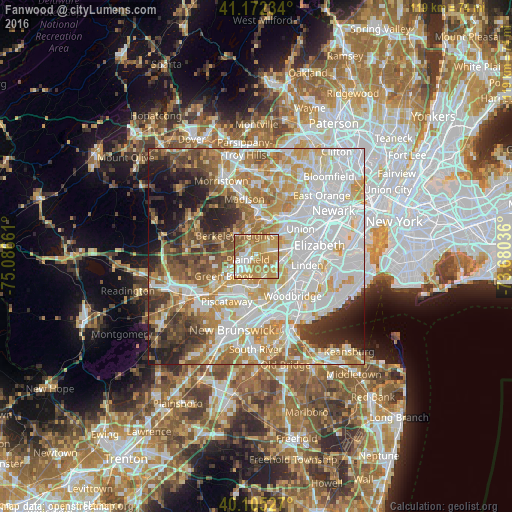
Analysis of Fanwood night lights 2016
Square area 10x10 km:
 11.53%
90-99
17.05%80-89
17.21%70-79
32.31%60-69
17.86%50-59
4.06%40-49
0%30-39
0%20-29
0%10-19
0%0-9
0%Square area 50x50 km:
23.39%90-99
16.64%80-89
8.69%70-79
10.96%60-69
8.96%50-59
6.86%40-49
5.67%30-39
5.24%20-29
6.33%10-19
5.54%0-9
1.71%Clear (daylight) street map image can be seen on geolist.org.
Map coordinates:
41° 10' 20.4" North, 75° 5' 11.8" West
40° 38' 27.4" North, 74° 23' 0.5" West
40° 6' 19" North, 73° 40' 49.3" West
Some cities around Fanwood sort by population:
• Plainfield
2.2 km =1.4 mi,  248°
248°
• Westfield
3.6 km =2.2 mi,  56°
56°
• Scotch Plains
1.7 km =1.1 mi,  341°
341°
• North Plainfield
3.9 km =2.4 mi, 251°
• Clark
6.1 km =3.8 mi,  90°
90°
• New Providence
6.6 km =4.1 mi,  346°
346°
• Mountainside
4.1 km =2.5 mi,  32°
32°
• Watchung
5.7 km =3.5 mi,  266°
266°
5097830 (p: 7,651)
Sources (retrieved 2019-11-25):
» Earth at Night: Flat Maps 2012, 2016