New Providence night lights from space
Night Light of New Providence (New Jersey) from space (United States) Src. Average luminocity for 10x10km area is 67.5065% and for 50x50km: 71.599%.
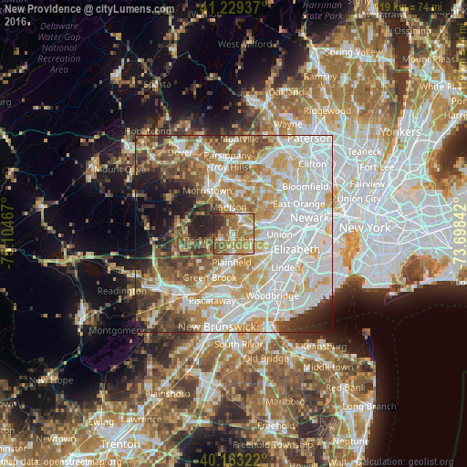
Analysis of New Providence night lights 2016
Square area 10x10 km:
 5.84%
5.84%90-99
8.44%80-89
12.99%70-79
16.56%60-69
27.92%50-59
13.64%40-49
4.55%30-39
5.52%20-29
4.55%10-19
0%0-9
0%Square area 50x50 km:
24.03%90-99
16.33%80-89
8.54%70-79
10.69%60-69
8.92%50-59
7.31%40-49
6.52%30-39
4.93%20-29
5.21%10-19
5.35%0-9
2.16%Clear (daylight) street map image can be seen on geolist.org.
Map coordinates:
41° 13' 45.7" North, 75° 6' 16.8" West
40° 41' 54.3" North, 74° 24' 5.5" West
40° 9' 47.6" North, 73° 41' 54.3" West
Some cities around New Providence sort by population:
• Westfield
6.3 km =3.9 mi,  133°
133°
• Scotch Plains
4.9 km =3 mi,  168°
168°
• Summit
3.6 km =2.2 mi,  58°
58°
• Madison
7 km =4.3 mi,  349°
349°
• Berkeley Heights
3.8 km =2.4 mi,  244°
244°
• Chatham
5 km =3.1 mi,  17°
17°
• Fanwood
6.6 km =4.1 mi, 166°
• Mountainside
4.7 km =2.9 mi, 127°
5101775 (p: 12,469)
Sources (retrieved 2019-11-25):
» Earth at Night: Flat Maps 2012, 2016