East Palo Alto night lights from space
Night Light of East Palo Alto (California) from space (United States) Src. Average luminocity for 10x10km area is 59.7792% and for 50x50km: 42.3166%.
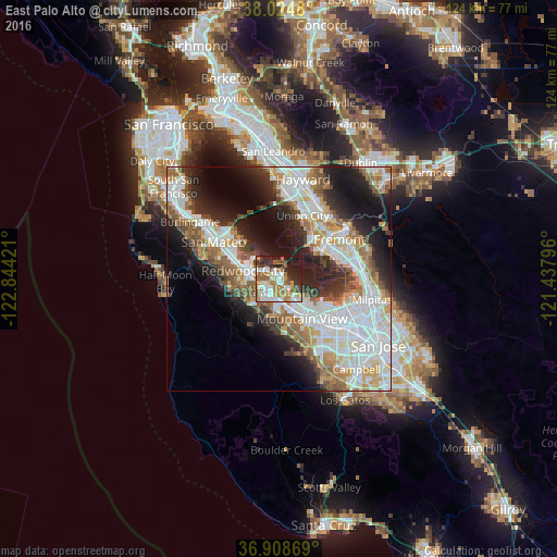
Analysis of East Palo Alto night lights 2016
Square area 10x10 km:
 12.34%
90-99
13.31%80-89
3.57%70-79
9.58%60-69
13.64%50-59
10.55%40-49
5.19%30-39
5.19%20-29
15.26%10-19
11.36%0-9
0%Square area 50x50 km:
11.76%90-99
10.49%80-89
3.06%70-79
4.83%60-69
5.42%50-59
5.59%40-49
3.98%30-39
4.14%20-29
8.57%10-19
12.54%0-9
29.62%Clear (daylight) street map image can be seen on geolist.org.
Map coordinates:
38° 1' 29.3" North, 122° 50' 39.2" West
37° 28' 7.8" North, 122° 8' 27.9" West
36° 54' 31.3" North, 121° 26' 16.7" West
Some cities around East Palo Alto sort by population:
• Redwood City
8.6 km =5.3 mi,  282°
282°
• Palo Alto
3 km =1.9 mi,  183°
183°
• Menlo Park
4 km =2.5 mi,  245°
245°
• Los Altos
9.6 km =6 mi,  165°
165°
• North Fair Oaks
4.9 km =3 mi, 277°
• Stanford
5.4 km =3.4 mi,  203°
203°
• Los Altos Hills
9.9 km =6.2 mi, 178°
• Atherton
5.1 km =3.2 mi,  260°
260°
5345032 (p: 29,662)
Sources (retrieved 2019-11-25):
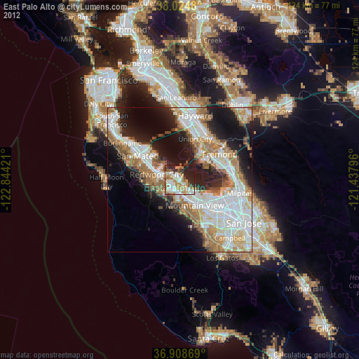
» Earth at Night: Flat Maps 2012, 2016