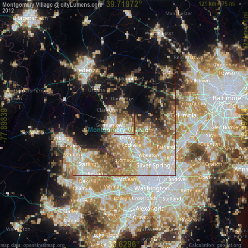
Montgomery Village night lights from space
Night Light of Montgomery Village (Maryland) from space (United States) Src. Average luminocity for 10x10km area is 76.1477% and for 50x50km: 47.2269%.

Analysis of Montgomery Village night lights 2016
Square area 10x10 km:
 18.67%
90-99
18.02%80-89
9.9%70-79
16.4%60-69
12.34%50-59
11.04%40-49
9.25%30-39
3.08%20-29
1.3%10-19
0%0-9
0%Square area 50x50 km:
9.47%90-99
9.23%80-89
6.08%70-79
6.99%60-69
8.02%50-59
8.21%40-49
5.28%30-39
5.32%20-29
7.88%10-19
14.96%0-9
18.56%Clear (daylight) street map image can be seen on geolist.org.
Map coordinates:
39° 43' 11" North, 77° 53' 54.2" West
39° 10' 36.4" North, 77° 11' 42.9" West
38° 37' 46.6" North, 76° 29' 31.7" West
Some cities around Montgomery Village sort by population:
• Germantown
6.6 km =4.1 mi,  266°
266°
• Gaithersburg
3.7 km =2.3 mi,  188°
188°
• Rockville
10.9 km =6.8 mi,  160°
160°
• Olney
11.4 km =7.1 mi,  103°
103°
• North Potomac
12 km =7.5 mi,  209°
209°
• Redland
5.6 km =3.5 mi,  128°
128°
• Clarksburg
10 km =6.2 mi,  313°
313°
• Darnestown
11.6 km =7.2 mi,  225°
225°
4362743 (p: 32,032)
Sources (retrieved 2019-11-25):
» Earth at Night: Flat Maps 2012, 2016