Rockville night lights from space
Night Light of Rockville (Maryland) from space (United States) Src. Average luminocity for 10x10km area is 85.8003% and for 50x50km: 62.4054%.
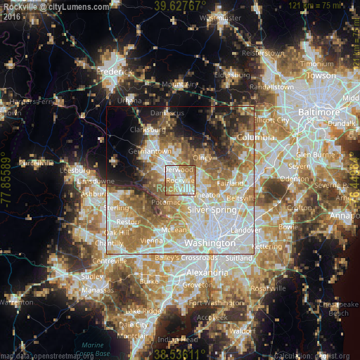
Analysis of Rockville night lights 2016
Square area 10x10 km:
 26.3%
26.3%90-99
23.86%80-89
11.85%70-79
18.67%60-69
17.21%50-59
2.11%40-49
0%30-39
0%20-29
0%10-19
0%0-9
0%Square area 50x50 km:
18.56%90-99
13.77%80-89
7.88%70-79
9.34%60-69
9.89%50-59
8.1%40-49
4.46%30-39
4.08%20-29
5.19%10-19
7.61%0-9
11.12%Clear (daylight) street map image can be seen on geolist.org.
Map coordinates:
39° 37' 39.6" North, 77° 51' 21.2" West
39° 5' 2.4" North, 77° 9' 9.9" West
38° 32' 10" North, 76° 26' 58.7" West
Some cities around Rockville sort by population:
• Gaithersburg
7.8 km =4.8 mi,  327°
327°
• Aspen Hill
6.9 km =4.3 mi,  94°
94°
• Potomac
8.8 km =5.5 mi,  213°
213°
• North Bethesda
5.3 km =3.3 mi,  146°
146°
• Redland
6.9 km =4.3 mi,  6°
6°
• North Kensington
9.1 km =5.7 mi,  130°
130°
• Leisure World
7.5 km =4.7 mi,  74°
74°
• Rossmoor
7.4 km =4.6 mi, 72°
4367175 (p: 66,980)
Sources (retrieved 2019-11-25):
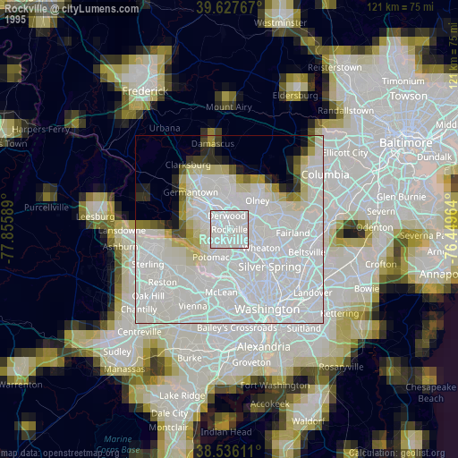
» NASA, Earths city lights 1995
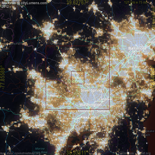
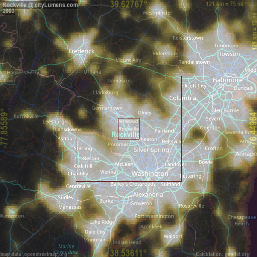
» NASA city lights 2003
» Earth at Night: Flat Maps 2012, 2016