Overland Park night lights from space
Night Light of Overland Park (Kansas) from space (United States) Src. Average luminocity for 10x10km area is 94.4935% and for 50x50km: 64.7163%.
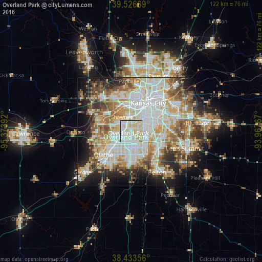
Analysis of Overland Park night lights 2016
Square area 10x10 km:
 31.17%
90-99
41.56%80-89
27.27%70-79
0%60-69
0%50-59
0%40-49
0%30-39
0%20-29
0%10-19
0%0-9
0%Square area 50x50 km:
18.27%90-99
17.06%80-89
9.23%70-79
7.4%60-69
8.27%50-59
6.92%40-49
5.58%30-39
5.22%20-29
6.75%10-19
9%0-9
6.3%Clear (daylight) street map image can be seen on geolist.org.
Map coordinates:
39° 31' 36.1" North, 95° 22' 26.1" West
38° 58' 56" North, 94° 40' 14.8" West
38° 26' 0.8" North, 93° 58' 3.6" West
Some cities around Overland Park sort by population:
• Kansas City
15.1 km =9.4 mi,  14°
14°
• Shawnee
7.9 km =4.9 mi,  327°
327°
• Lenexa
6.3 km =3.9 mi,  239°
239°
• Leawood
5 km =3.1 mi,  110°
110°
• Prairie Village
3.4 km =2.1 mi,  71°
71°
• Merriam
5 km =3.1 mi,  336°
336°
• Mission
5.2 km =3.2 mi, 14°
• Roeland Park
7 km =4.3 mi,  28°
28°
4276873 (p: 186,515)
Sources (retrieved 2019-11-25):
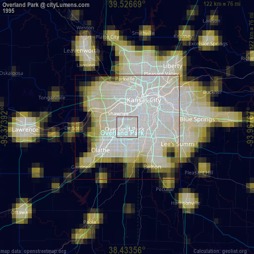
» NASA, Earths city lights 1995
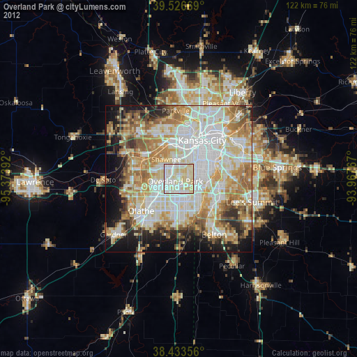
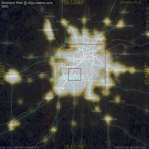
» NASA city lights 2003
» Earth at Night: Flat Maps 2012, 2016